
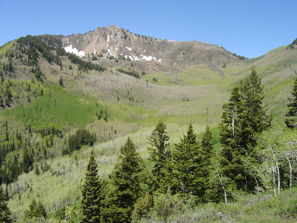

Mount Raymond is a classic Wasatch Mountain hike; the pyramid-shaped summit can be viewed from many points both in the Salt Lake Valley and from high in the Cottonwood Canyons. Rising to 10,241 feet, Raymond’s peak is a lofty perch that provides spectacular views of the surrounding summits. The best part about it? All that is required to reach the top are a strong set of legs and a desire to get elevated.
There are several approaches to Mount Raymond, but for this description you start off from the Butler Fork trailhead 8 1/2 miles up Big Cottonwood Canyon. Parking is plentiful on the north and south sides of the road. The well maintained trail begins with a steep climb near a stream, and soon enters the Mount Olympus Wilderness Area. Shortly after the trail evens out, hikers come to a fork; the trail to Dog Lake continues east, but you want the branch to Mill A Basin. The trail stays close to the stream in the lower portion; massive fields of wildflowers encircle you.
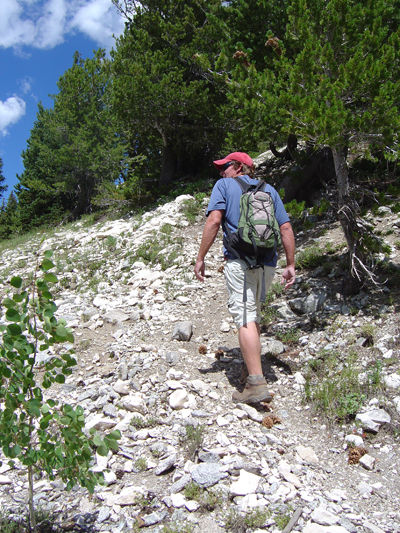
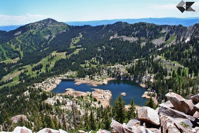
Time to climb again! The trail heads through the first of several aspen groves as it begins switchbacking up the Mill A drainage. You can expect to gain close to 1,000′ in the first hour of the hike. About this time the trail levels off again and offers another fork; head south down a small side track to Circle- All Peak. Here you can take in excellent views of Kessler Peak and the Broads Fork Twin Peaks Massif. Head back to the main trail and continue up the ridge line for another 1/4 mile until you hit the junction for Desolation Trail. At the sign, turn left and continue towards your destination; Mount Raymond looms just in front of you for the remainder of the hike. The going is easy for this portion; a gentle incline eventually leads you to Baker Pass. Once you arrive at the saddle between Raymond and Gobblers Knob, the real hiking begins. It is another 1,000′ to the top of Raymond, so grab a quick bite and drink up. The trail to Raymond’s summit is initially easy to follow; a well marked path snakes between the rocks and pines of the lower summit ridge.

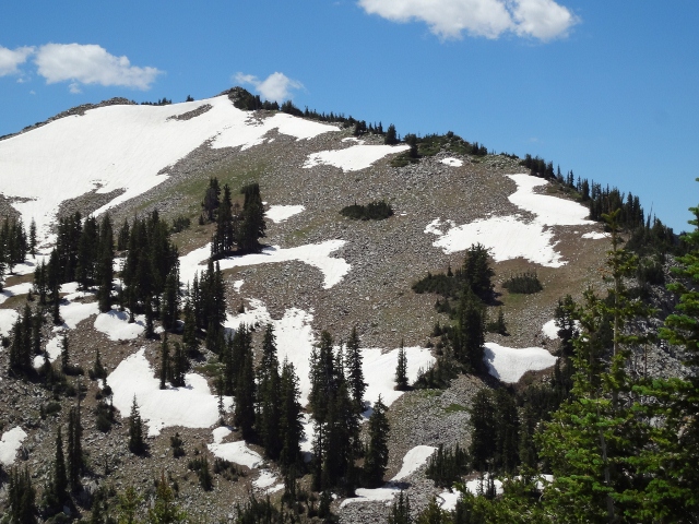
It is not unusual to find large snowfields on the ridge well into summer; I hiked this trail in late June and was able to use the snowfields as a way to save my ankles from the harsh rocks of the trail. Use your head when hiking on summer snow; trekking poles are a big help in these areas. Soon the trail becomes mostly rock, and you encounter the biggest obstacle of the hike: a short section where the ridge becomes a knife edge. It looks daunting to the casual hiker, but the footing is good and the cautious amongst you can get down into a mountain goat stance and make your way up it with no trouble. I’ve even seen a few adventurous dogs do this section with no problems!

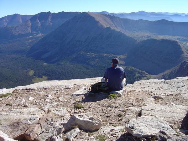
After the knife edge there is more scrambling with some exposure, but nothing over Class 3. Scramble up and around boulders on the faint trail. The summit ridge is easy to follow and leaves you little margin for error. Scan the final 200 feet for trees that have been struck by lightning; a true testament to the fierce weather of the Wasatch. Push up to the the peak and take a load off; the views are incredible up there. The Twin Peaks Massif towers to the south, over 1,000 feet taller than Raymond. Gobblers Knob to the northeast and the Wildcat Ridge to the west are so close you feel like you could reach out and touch them. Read through the summit register before signing, some of the entries are pretty comical. Take in the scenery and head down the way you came.

The beauty of Mount Raymond is that the summit is attainable for hikers of all ages and experience. In fact, the knife edge and summit ridge serve as a great way to build experience for more intense hikes in the Wasatch. But this is not a walk in the park; as with most Wasatch hikes, Raymond is steep: 3,161′ in 4 1/4 miles. The burn in your legs is a small price to pay for the rewarding views and feeling of accomplishment once you reach the top. Allow 4-5 hours round trip for this Utah favorite.

I am interested is using one of your photographs in a small book I am working on about hiking trails near Salt Lake City. The photo is of the knife-edge below Mount Raymond, taken by Ryan Malavolta. Is this possible?
David Day
1913 Skyline Drive
Orem, Utah 84097
801-356-2733
You say you’ve seen some dogs along the knife edge – are they coming in from the Millcreek side? Because dogs are not allowed up the BCC side up Butler Fork. Might want to clear that up for other readers that are not familiar with watershed rules. – Alicia @ http://www.girlonahike.com
I think you just did. 🙂