Think of Utah slickrock, and Moab immediately springs to mind. But the fact is, some of the best slickrock mountain biking in the state can be found on Gooseberry Mesa, just outside Zion National Park. It’s no secret among the fat tire community that Gooseberry Mesa features some of the most awesome, if not legendary, mountain bike rides in southern Utah. But everyone needs to go back down there from time to time, just to be sure.

Gooseberry Mesa is a flat-top mountain sandwiched between Zion and the hamlet of Hurricane, Utah. The primary type of mountain biking found here is technical slickrock and singletrack that flows through juniper bushes and pinion trees. There’s a whole network of trails that crisscross the mesa, but one ride stands as the longest, most epic jaunt – the South and North Rim Loop.
Combining the South and North Rim into one big ride gives you almost 13 miles of technical slick rock, swooping singetrack, and scenery unlike any found elsewhere in Utah. But unlike the smooth, horizon-line slickrock of Moab, Gooseberry Mesa is all about taking things easy with steps, drops, and small hills that require bursts of speed to clear. As such, 13 miles may sound like a short ride on paper, but on Gooseberry, it’ll take you most of the day.

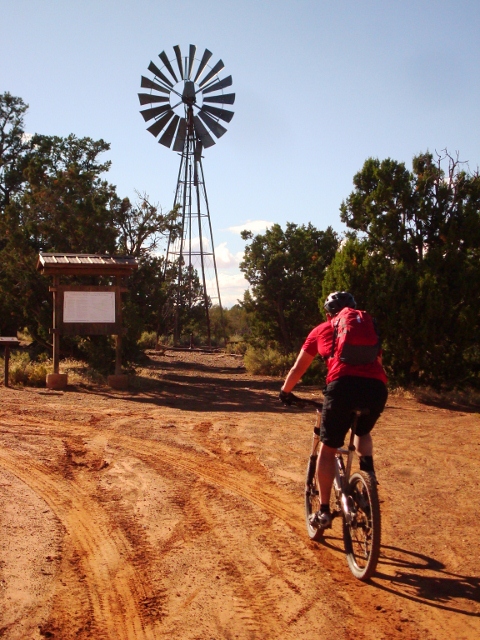
The ride along the mesa rim begins at the Cattle Grate trailhead. It’s a large parking lot at the end of the Gooseberry Mesa road that terminates at a cattlegrate and fence. The ride begins when you bike past the fence and turn immediately left (south) on the Cattle Grate Trail. The path starts out easy enough, with packed dirt singletrack and and fun turns.
But then about two miles in, things get challenging. God’s Skateboard Park is the next section, and it’s known for crazy ramps, steep ascents and descents, shelves and any number of obstacles that threaten to throw you off your saddle. Beginners will hate it and walk most of the ride. But experts will have a heyday as they play on this slickrock terrain park.

Eventually, the ride passes Hidden Canyon, another excellent trail, at 3.5 miles. But to complete the whole loop, stay left on Rattlesnake Rim. It’s more of the same here as you attempt to pedal from point A to point B without dismounting on sometimes easy, sometimes insane rock features. The difference here though, is you get your first views from the edge of the rim of the immense desert of southwestern Utah in all its splendor.
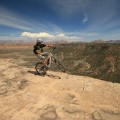
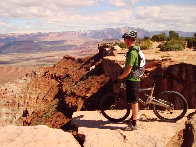
The climax of the ride comes soon after when you reach The Point. The trail veers left at mile seven for a quick out and back to an overlook that is truly breathtaking. You get a 360-degree view of Zion National Park, the Virgin River Gorge, Pine Mountain, and even the Mojave Desert far to the west. The Point is about the best spot in the world to have some lunch and take in the overwhelming landscape the surrounds you and the bike that got you there.

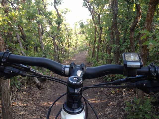
To continue the Rim Loop, go back to where you veered left to reach The Point, then east on the White Trail doubletrack until you see That Damn Trail. Go left and you’ll soon be spinning on fun singletrack through pinion forests that weave in and out of the north rim.
After about 11 miles, the ride goes back toward the middle of the mesa and enters a huge section of gray slickrock called Slickrock 101. It’s much easier than the slickrock found on God’s Skateboard Park, but is no less fun. Also called The Practice Loop, this part of the ride is great for beginners to practice their slickrock bike-handling skills. Eventually, the loop ends up back at the White Trail double track at mile 12, where a left turn gets you back to the parking lot in no time.

If you’ve never been to Gooseberry Mesa, or it’s been a while, don’t worry because navigation is easy. All trails are well signed, and painted white dots show you the way through the slickrock sections. If you do get lost, keep going on a trail, because all paths eventually lead back to the White Trail double track that goes back to the parking lot.
If you visit Gooseberry Mesa, camping there is highly recommended. While there are no established camp sites, the whole mesa is public land, which means you can pitch a tent wherever you can find a clearing. There’s nothing better than spending a few nights camping on Gooseberry at night, and goofing off on the trails by day.
There are two ways to get to Gooseberry Mesa. From the north, drive from La Verkin to the small town of Rockville, just west of Springdale. In town, go south on Bridge Road, following the signs to Gooseberry Mesa. Around 6 miles from town, a road appears through a break in a fence on the right that goes to the top of Gooseberry.
From Hurricane, drive southeast on Highway 59. About 15 miles later, you’ll see a sign for Gooseberry Mesa. Turn left here onto a dirt road that heads north. A few miles later, turn left onto the dirt road that leads to the trailhead.