
There a new map of the Central Wasatch for backcountry skiers, and it’s a doozy. The Wasatch Backcountry Skiing Map by Steve Achelis is the most comprehensive map we’ve seen. It features every known, named ski route in Mill Creek and the Cottonwood Canyons, which covers over 1,100 skiable lines. In addition to the indexed, full-color, waterproof paper map, their website WasatchBackcountrySkiing.com is an interactive Google Earth map that shows each run in 3D, and features a search function by using a number system printed on the map.

For example, if you want to get a better look at Oingo Boingo in Days Fork, you simply find it on the alphabetical chart located on the back of the map, and type the corresponding code (in this case 2603.) You’re then immediately taken on a zoomed-in ride through the range until the virtual map stops at your desired locale. You can also search by name.

While it may sound like a map akin to a ski resort map, rest assured, it’s not. It’s a full-on contour map with lines displayed every 40 feet with dark contour lines representing 200 feet. Names of routes are superimposed over the location of the run. The map also gives mileage from canyon mouths to trailheads, and includes canyon and peak names and elevations.

The best part of the new Wasatch Backcountry Skiing Map? All profits from the sale of said map are donated to non-profit organizations that promote avalanche safety, like the Utah Avalanche Center.
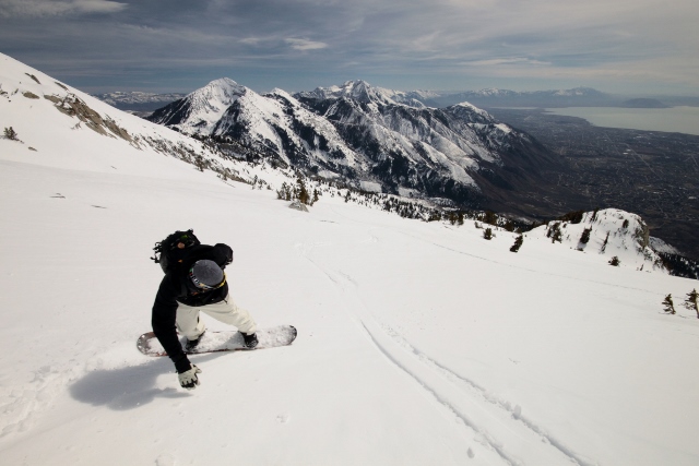
Of course, there’s an ulterior motive is the release of this map, and it could save your life. Imagine you and your friends drop into a run somewhere between Big Cottonwood and Millcreek. The slopes slides and your friends are injured or worse. You call 911, but when dispatch asks your location, you can’t give them a specific spot because you don’t really know where you are. But with this map, you can now pull it out, find your place on the map, and tell the dispatcher you’re halfway down “Rocks Off” on Gobblers Knob. With that specific run name, rescuers will know exactly where you are and get to you faster.

The maker of the map clearly has done exhaustive research of all the names and places in the Wasatch. They say early and modern backcountry explorers and experts were tortured with thumb screws until they gave up the secret names of every killer line a pair of skis has ever been put to. Of course, they want to know if they missed anything or made a mistake, so if you catch something or want to include a route, they ask that you visit www.wbskiing.com/naming.
The Wasatch Backcountry Skiing Map is going to be standard issue in the packs of every backcountry skier and snowboarder in Utah. By knowing the names of runs, and having a clear understanding of the layout, terrain and nuances of the Central Wasatch, touring parties will be more informed, and can then make more informed decisions when planning routes for the day.
The physical map costs $12.95 and can be ordered at www.wasatchbackcountryskiing.com. The Google Earth virtual map can also be found and played with online along with vital avalanche and weather links. You can also purchase the physical map at the Black Diamond Store in Salt Lake City. Go get it!
Thanks for the great coverage of the map, Jared. While I was extracting data from all the backcountry experts, I definitely read your posts about backcountry skiing in the Wasatch to make sure the names were in agreement.
Stay Safe!
Steve
Hey, that’s awesome Steve! And thank you for making the map. We’ve been using it a ton this season so far. It’s been much needed… now get to work on the rest of Utah’s mountain ranges! 🙂