
If you want life list hikes, Utah has them in spades. High on the list for me and a few friends had been Coyote Gulch in Grand Staircase Escalante National Monument. This riparian canyon boasts a natural bridge, huge alcoves, numerous arches and a stream that flows year round. Well, after many years of dreaming of the gulch, I’m happy to say I can take it off of my list. We targeted Coyote for our annual late April desert trip, and I can assure you that this one is worth every sweaty mile.
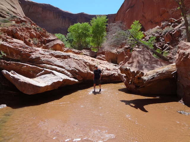
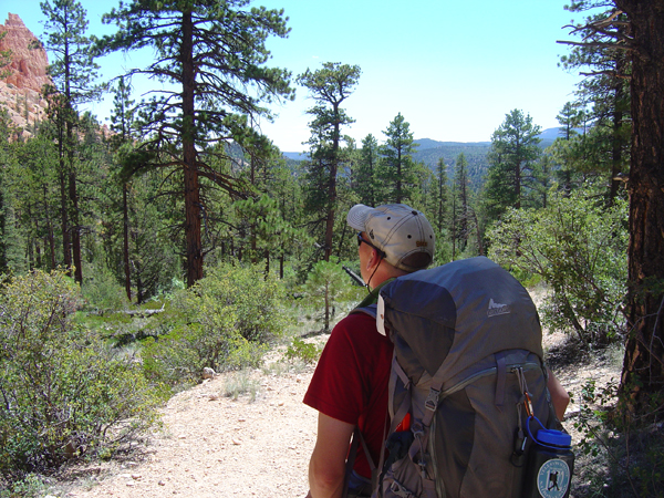
Our trip began at the Chimney Rock trailhead, roughly 34 miles down Hole-in-the-Rock Road. If you’ve never traveled to this area, consider this road as the gateway to adventure. Numerous trailheads and side roads lead to mind blowing canyon country; it seems you could fill up years worth of playtime by simply driving down this back street and finding a new canyon. We donned our packs and descended towards a small crack in the earth: the upper end of Coyote Gulch. We got a late start, so the spring sun was high overhead and somewhat relentless as we made our way across soft sand and in between cow pies. After an hour of this arduous hiking we finally plunged into the canyon proper. Immediately we noticed that the water was flowing strong (strong meaning a foot deep in places, and up to four feet wide) and Coyote Gulch was in near full bloom. Cottonwood trees displayed their brilliant green leaves, and a number of bushes and flowers had recently bloomed, or looked to be just days away. We plodded down the canyon, taking in all the sights and sounds as we neared the confluence of Coyote Gulch and Hurricane Wash.

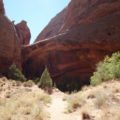
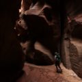
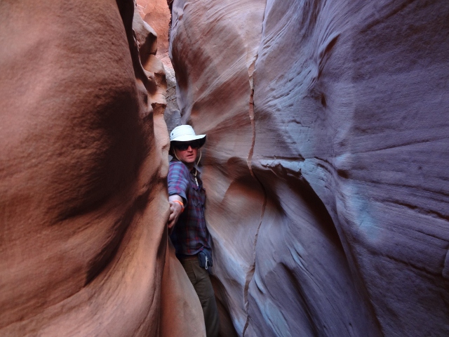
One of the first things you will notice about the gulch are the high and brilliantly colored walls that hem you in at every turn. Rather than ominous, these walls seem inviting, almost warm. After we arrived at the confluence area, it seemed the walls immediately got higher, and the canyon even twistier. In Coyote Gulch, you don’t measure distance by miles, but rather by how many bends in the canyon. After passing Hurricane Wash, our group began scoping for campsites. We planned to make a base camp for two nights, so we wanted a spot we really loved. There is no shortage of excellent places to camp down here, and we finally settled on a winner just a few bends up from Jacob Hamblin Arch (one of the main features in the region). Tents were pitched, boots unlaced, and the whiskey came out for celebratory cheers. We spent the rest of the afternoon enjoying the cool water of the stream and relaxing in camp. Our planned hike for tomorrow promised to be a big one, so we all turned in early to rest up.
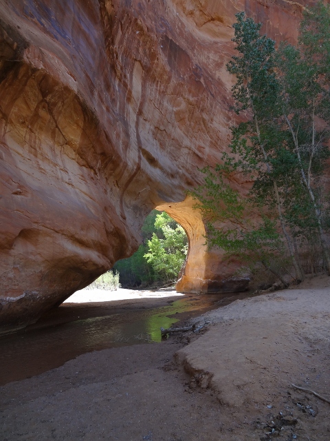
From the Jacob Hamblin Arch area, Coyote Gulch winds its way all the way to the Escalante River, roughly 4.5 miles away. Our goal was to hike the whole distance and take in as many sites as possible. Our small daypacks were a relief after the 5 mile trek in with backpacks, and we plunged into the stream with big smiles. We quickly arrived at Jacob Hamblin Arch; an impressive site, indeed! The arch is nestled between bends in the canyon, and a massive pile of rubble lies at its feet. It’s possible to scramble right up to the top, but we opted to save our energy and enjoy Jacob Hamblin from below. As we continued downstream we were dazzled by the monstrous alcoves carved by water, wind and time. Each undercut seemed bigger than the one before it. Birds were singing in the canyon and the sun soon made us happy to have our feet in the chilly stream. The next big attraction on this hike is Coyote Natural Bridge. Here, the stream flows right under a hole cut through the rocks, and it provided the perfect place to snap some pictures and enjoy a short break.
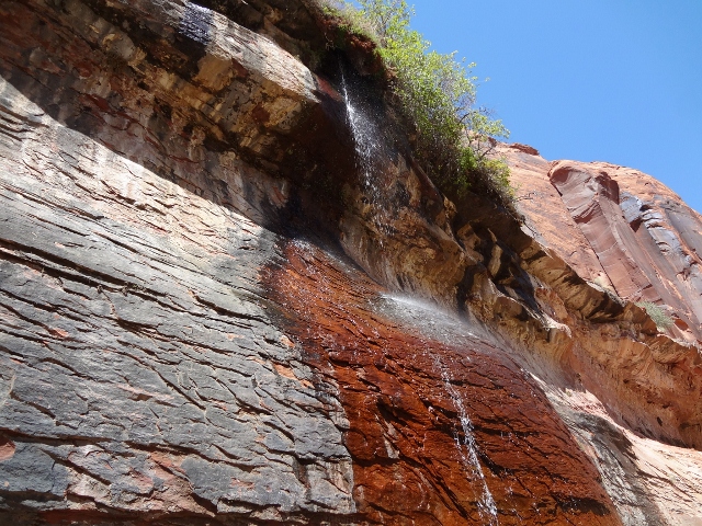
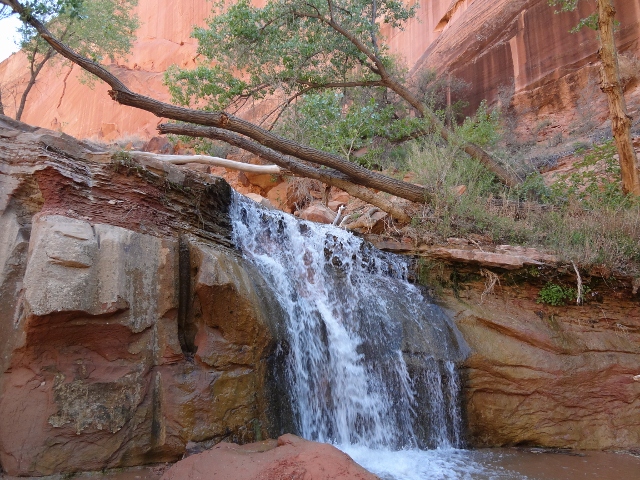
I cannot oversell the amount of beauty hidden in these canyon walls. As we followed the creek, we saw many awe-inspiring sites. Everything from natural seeps pouring out of the walls (with water so clean you can stop for an unfiltered drink) to waterfalls (some tiny, like the aptly-named Swiss Cheese Falls, to a series of four big falls perfect for taking a desert shower under). Songbirds, raptors and ravens flew above our heads, and created a grand hiking soundtrack. More arches, like Cliff and Jughandle could be seen high above us. Flowers and cacti of many varieties were mixed in with the cottonwoods and shrubbery, and they were a good reminder of why I need to start carrying a field guide with me on these adventures. We strolled down canyon, sometimes under the hot sun, sometimes in shade, and noticed the prints of the canyon denizens in the wet sand. Deer, turkey and even mountain lion tracks were readily identifiable. Finally, we scrambled over a very dicey slick rock trail high above the stream and some plunge pools before meeting up with the Escalante River. There, we ate lunch on the rocks before turning around and enjoying all the sites in reverse.
The total time for our hike was approximately 8 hours, but we were moving very slow. There was simply too much to see in Coyote to rush ourselves! Back in camp, we reflected on everything we had seen that day. We had planned to spend two nights at our camp, which turned out to be a great call because I simply did not want to leave. I slept under the stars and once again listened to the babel of the numerous frogs that call this canyon home. We made our slow exit the next morning, and like many excellent trips from the past, ended things with some cold beer and tasty food on the front porch of Escalante Outfitters. I can now check Coyote Gulch off my Utah life list, but it sure wouldn’t take much to get me back down there.
Getting There: From the town of Escalante, drive 5 mile east on Route 12 and turn south on Hole-in-the-Rock Road. The road is graded/washboard and suitable for most vehicles in good weather. Chimney Rock trailhead is 33.7 miles south. Be aware that the road to the trailhead contains soft sand and rocks, and may not be passable by smaller cars. There are many other trailheads in the area that also provide access to Coyote Gulch, so it all depends on where and how you want to begin your hike.
Maps: Big Hollow Wash, King Mesa, and Stevens Canyon South (US 1:24 topo maps), or Trails Illustrated Canyons of the Escalante map
Essential Gear: good hiking boots for the way in, water shoes for dayhiking/stream crossings, reliable water filter and plenty of sunscreen.
Nice description of your trip. Coyote Gulch has been on my list for many years. I still have to get there. This just makes me want to go all the more!