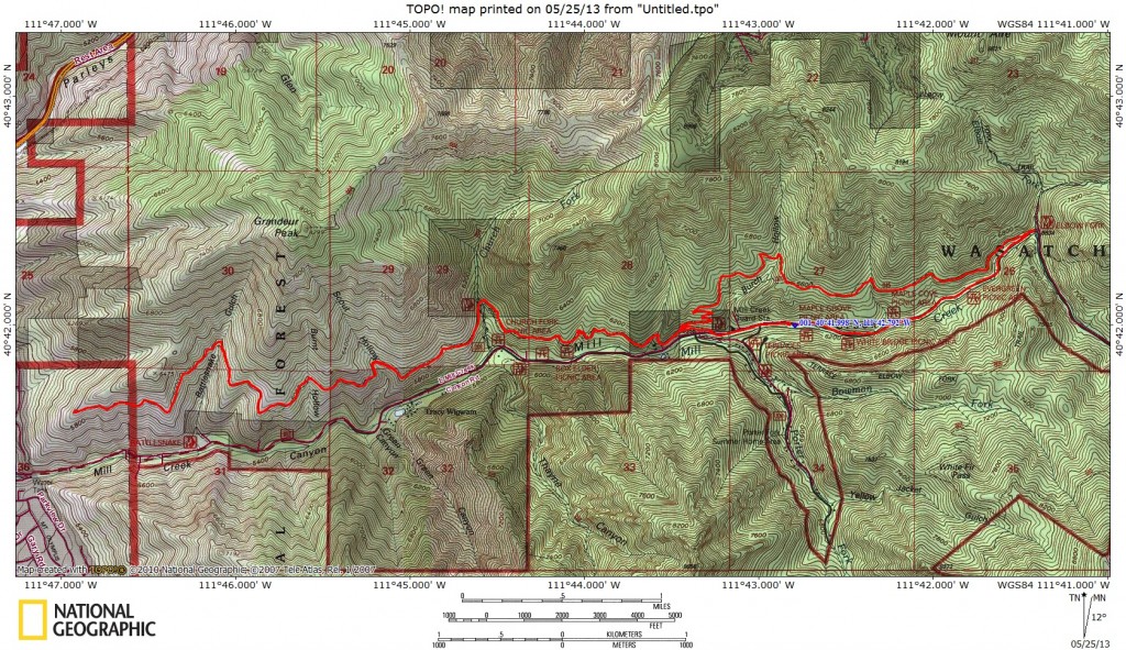
Start Point: Mill Creek Canyon winter gate, 6100 feet
End Point: Pipeline Trail viewpoint, 5960feet
Trail Distance: 13.6 miles (round trip)
Trail Time: 2 hours
Skill Level: Beginner
Best Season: Spring/Fall
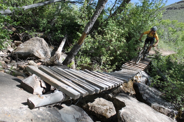
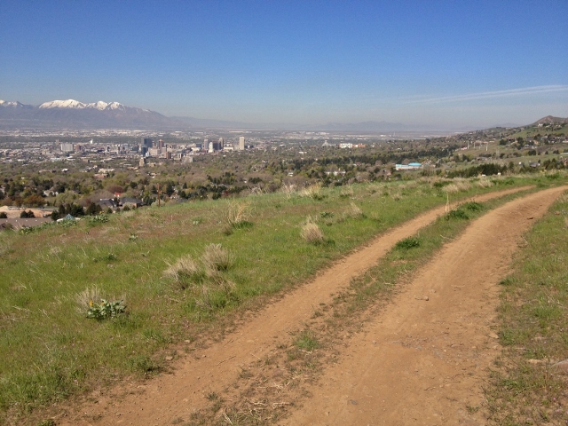
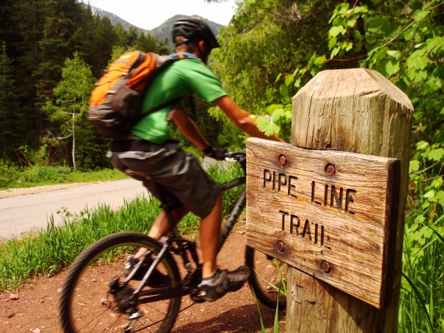
The Pipeline Trail is one of Salt Lake’s premiere, beginner, mountain-bike trails. It’s relatively flat, has few technical rocky sections, and there are several ways to get in and out in case you need to bail back to the road. While there are a few areas more suitable for intermediate riders like steep drop-offs at trail side, tight switchbacks at Burch Hollow, and loose rocks near the viewpoint, it’s all stuff good for launching the knee-quivering newbie to seasoned rider status. The trail also has appeal for all riders because of fast singletrack through glades of oak trees, buff dirt, and that viewpoint overlooking the Salt Lake Valley at the end. But the Pipeline is also popular with trail runners and hikers with dogs, so it’s not a good place for race-pace pedaling.
Although there are several ways to mountain bike the Pipeline Trail, the route description below is my favorite out-and-back variation as it includes the entire trail while limiting time spent on the paved road. Also, while the start and end point have about the same elevation, there is a 600-feet elevation gain and loss from Burch Hollow to Elbow Fork and back.
Getting There: Drive on the east loop of I-215 in Salt Lake City, and exit at 3900 South. Turn north, go one block, and turn east on 3800 South into Mill Creek Canyon. Drive 4.3 miles to the winter closure gate just past Porter Fork and park here. The gate to upper Mill Creek Canyon is open to vehicles from July 1 to November 1, but you can ride your bike up the road any time.
The Ride: From the parking area at the Mill Creek winter gate, ride your bike up the paved road for 1.5 miles to Elbow Fork. Locate the Pipeline Trail on the north side of the road, just west of a Forest Service outhouse. From here, the ride on singletrack begins. Follow the trail west through forests of Gamble Oak trees as it meanders along the hillside. This section is one of the easier parts of the ride as it’s mostly flat and the trail is very well maintained with few rocks. The only elevation gain happens where the trail switchbacks in tight drainages, but these hills are small.

2.3 miles from Elbow Fork, are the Burch Hollow switchbacks. This area may intimidate beginners as the dirt becomes loose and the switchbacks are tight as the trail descends almost back down to the road. It’s also a very crowded spot for day hikers so extreme caution is needed here. At the bottom of the switchbacks, you’ll come to an intersection. If you want to cut the ride short and bail, go left down to the road, where a short ride up the pavement gets you back to the car. Otherwise, go right (west) to continue on Pipeline.
From Burch Fork, it’s 3.4 miles of more buffed-out singletrack to Rattlesnake Gulch with only one steep up/downhill section that beginners will likely dismount and walk (but is a good grunt for experienced bikers.) At the well-signed Rattlesnake Gulch, there is another exit to the road, but this downhill is very steep with lots of drops and tight switchbacks – recommended for experts only. After Rattlesnake Gulch, the Pipeline Trail becomes filled with loose rocks, and also has a lot more exposure as the hillside drops steeply away on the north slope. While this may be dizzying for inexperienced riders, it also mean you’s got one hell of a view as you pedal.
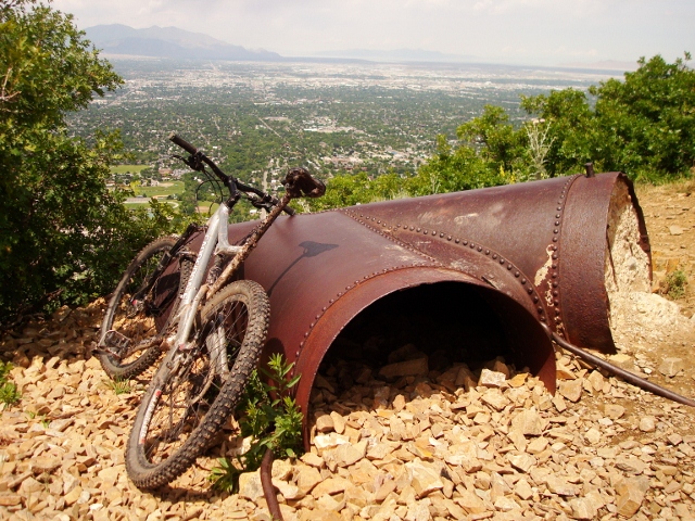
At the end of the rocky, trail-in-the-sky section, the Pipeline Trail ends at the viewpoint. There are old sections of pipe (hence the trail’s name) and lots of boulders where you can sit, eat a snack, and take in the sweeping view of the Salt Lake Valley and the Olympus Cove neighborhood below. Once you’ve had your fill of the scenery, simply ride back the way you came to Burch Hollow and pedal up the Mill Creek Canyon Road back to your car for a 13.6-round trip ride.
GPS track created using the Suunto Ambit.