
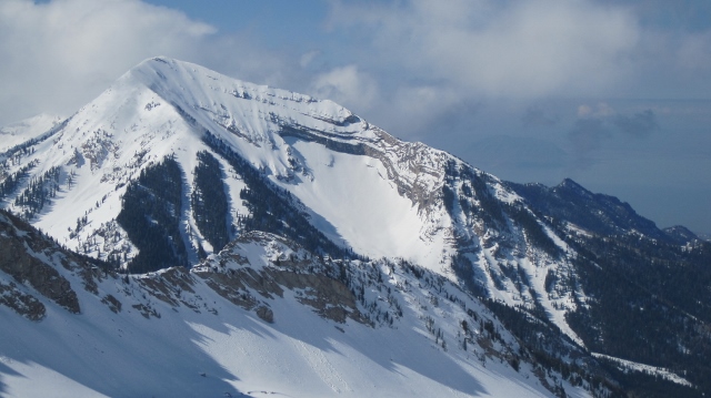
Lone Peak is one of those iconic, Wasatch mountains that just begs to be skied. If you look at her from the south as she rises high above the town of Alpine, gigantic ramps of south-facing slopes call out. Every time I drove north from Utah County in the winter, I would promise myself to backcountry ski one of those perfect-looking corn runs. This year, I kept that promise.
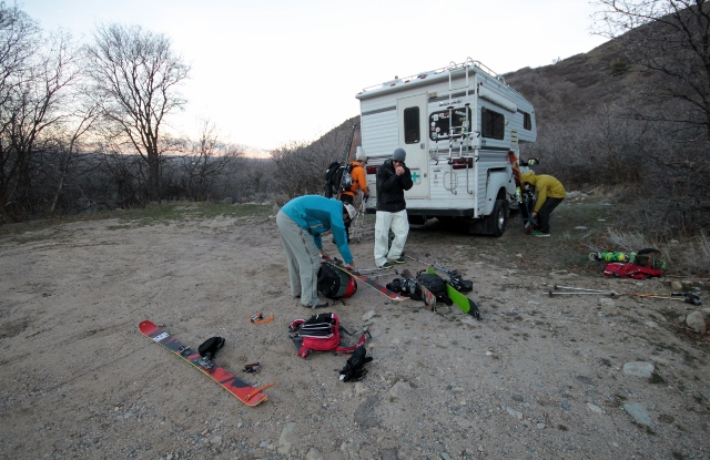
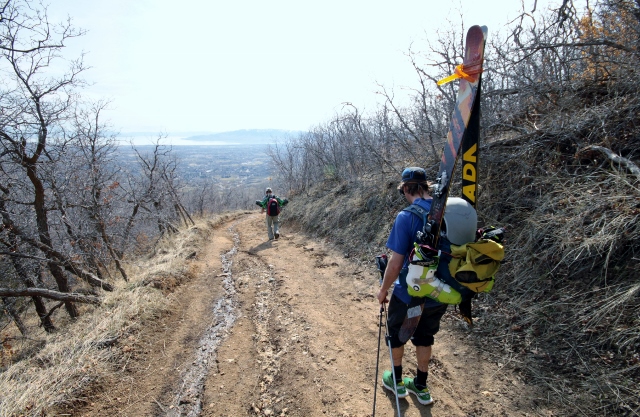
Spring skiing in the backcountry requires an early start, so I rallied Adam Symonds, Mike DeBernardo, Jon Stickland and John Monstrola before dawn, and we loaded up in Adam’s giant “yurt on wheels.” We got to the Lone Peak trailhead in Alpine just as it started to get light. The snow line looked to be about 2 miles and a few thousand feet above us, with nothing but brown hillsides and scrub oak forest below. So we strapped skis to our packs, left our sneakers on, and started walking.
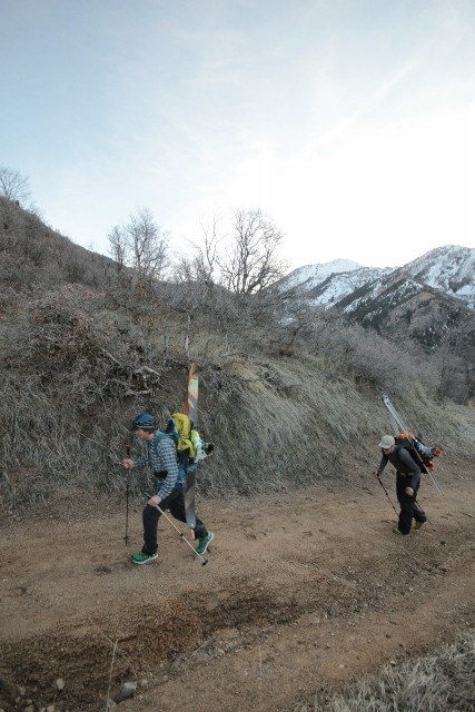
The trail was actually a closed, dirt road that switched back up above the town of Alpine. After about a mile or so, it narrowed and became snow covered. We kept hiking because of the occasional bare spot, but soon reached the First Hamongog, an open meadow on the mountainside. Hamongog is a biblical name of a valley that I’m sure a Mormon pioneer was responsible for bringing to the map of Lone Peak.

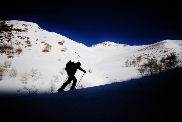
Enough snow buried the Hamongog that we could finally put our skis and skins on. It wasn’t long though, before we took them back off and hiked up a steep and narrow jeep track to a small side canyon that brought us to the Second Hamongog. At this evergreen-ringed meadow, the snow was most definitely uninterrupted, so with skis on our feet once more, we began the work of ascending those beautiful, south-facing ramps on Lone Peak.
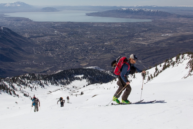
From below, the south face doesn’t look all that big, and we all estimated we’d be on the summit in a few hours. But the climb is thousands of feet of vertical and it took us much longer than we thought. Luckily, the slope angle is low, between 20 and 30 degrees, so skinning was mellow and easy – perfect for casually taking our time to gawk at the spectacular views along the way.
But we couldn’t dally too long, for the day was warm and the sun intense. All that solar energy was softening the south-facing slopes, and fast. We had to hurry if we were going to ski corn, or else be forced to slog through manky slush or snow transformed to the terrible consistency of mashed potatoes.
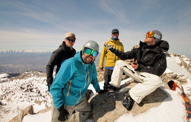
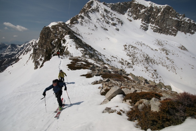
We stood upon the summit at 2 p.m. I’ve been atop Lone Peak twice before, both times in the summer after rock climbing in Lone Peak Cirque. Even so, the view from the top still amazes. Cliffs that wouldn’t be out of place in Yosemite ring all around, and fall away for thousands of vertical to the cirque floor below. To the north and east, the whole of the Central Wasatch stretches out, where we debated the names of peaks that look different from this unfamiliar angle. But the best view was to the south, where Box Elder beckons with her massive cliffs, and Timpanogos leads the eye as far as Mount Nebo on the horizon.
After photos and a bite to eat, it was time to ski some corn.
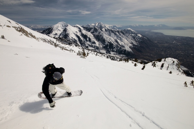
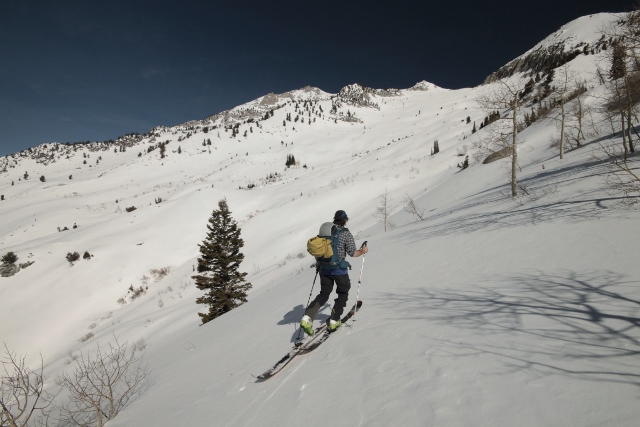
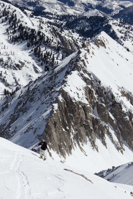
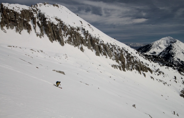
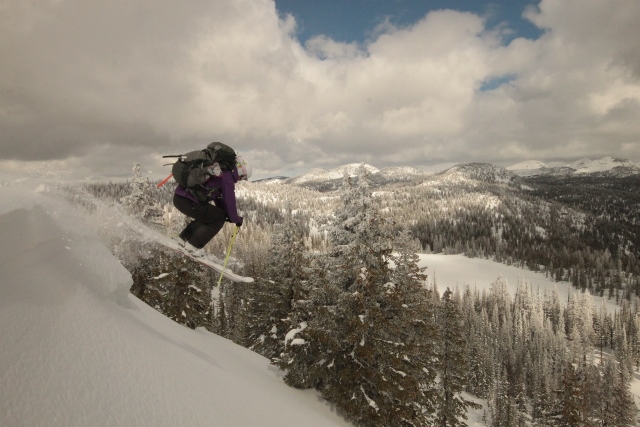
Wind and cold temperatures kept the snow up high a bit icy, but just a few-hundred vertical feet down, we hit the jackpot. Pure cream and carveable corn yielded to our ski tips. John sped down on his splitboard, hollering with joy at the perfect snow. As Mike and I followed on skis below the impressive top of Bighorn Peak, Adam and Jon flew above our heads with their speed wings all the way down to the Second Hamongog. The descent was long and joyous.
Of course the snow ended at the first Hamongog, which we reached after a terrible bushwhack through scrub oak as we attempted to follow the summer trail route down. That was a bad idea. Back at the road, it was skis on packs once again for the final hike down to the truck, where cold beer and post-tour celebration awaited.
Lone Peak is a big, intimidating mountain, but if you want to ski her, those south-facing slopes are really mellow. While the ascent is long and it requires a full day of spring touring, there’s no reason not to bag this Wasatch summit, and experience some of the best corn skiing Utah has to offer.
Do you have a GPX from this tour? A couple friends and I are planning this tour soon, and having a GPX to look over for prep would be nice. Not tons on the route up out there on the web.
Hi Mike,
I wrote a guide book that includes this route. Here is the link:
http://www.mountaineersbooks.org/Backcountry-Ski-Snowboard-Routes-Utah-P1633.aspx
Thanks for your support!