
There is so much backcountry ski terrain along the Wasatch Front, it’s super easy to explore world-class terrain right in our own backyards. But somehow, certain areas, despite their ease-of-access, get overlooked. The Wellsville Mountains above the Logan Valley are one such place, but there’s no reason for it. These mountains are steep (supposedly the steepest mountain range in North America) and have ski terrain featuring long, consistent fall lines that rival anything in the Central Wasatch.

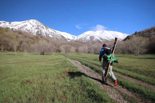
Adam Symonds and I took a trip to the Wellsvilles to ski this uncrowded paradise. It was late April – probably too late to be skiing in the lower-elevation Wellsvilles, but we were committed. So we got up early, made the hour-long drive to Sardine Canyon between Brigham City and Logan, and parked at the Rattlesnake Canyon trailhead, right off the highway. This canyon provides the most straightforward access to the Wellsvilles, (the once-popular Pine Canyon trailhead was blocked off by a locked gate and private property sign) and gets backcountry skiers into the good stuff without much fuss. The late season forced us to hike on green grass for the first couple of miles, but after following the summer trail onto a steep sub-ridge, we hit snowline and finally put skins to skis.
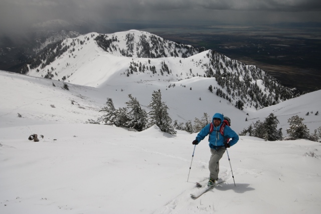
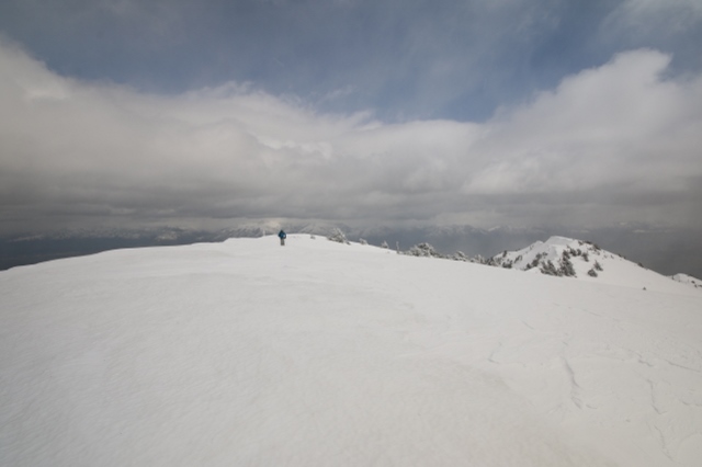
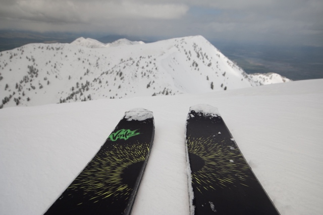
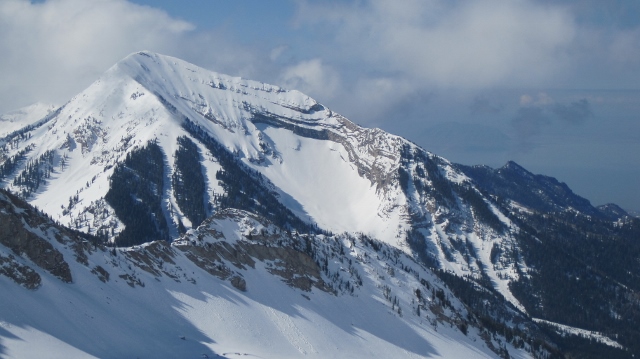
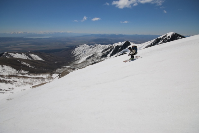
Box Elder Peak is the highest mountain in the Wellsvilles, so that was our ultimate goal. By following the summer trail route, we made good time to the top of the range where a long traverse on the undulating summit ridge took us directly to Box Elder’s summit. The view of Northern Utah from here was unique as we could gaze down on the Great Salt Lake to the west, and the green farm-country surrounding Logan below the Bear River Range to the East. After scoping out sweet lines on the Wellsville Cone and the east face of Box Elder, we opted to instead ski a long, south face of a sub-peak back to our ascent route because of an approaching storm.
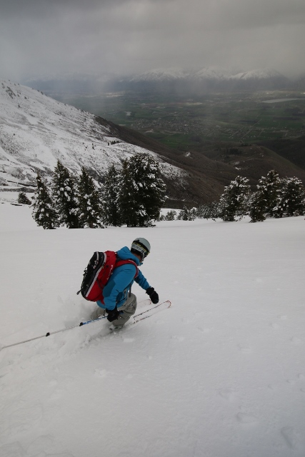
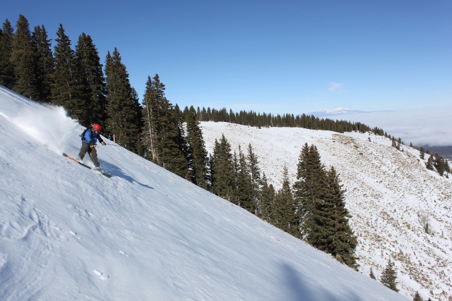
The first run was a delight. Long, easy turns on punchy spring corn gave way beneath our ski tips as we carved away hundreds of vertical feet. Back below the ridge where we started, we put skins back to skis and traversed the other direction, south, to Mitton Peak. From afar, we scoped out a long, east-facing line along subridge fingers that spill all the way down into lower Rattlesnake Canyon – the perfect exit run. After checking the snow and finding it had a wet-but-stable quality, we dropped in.
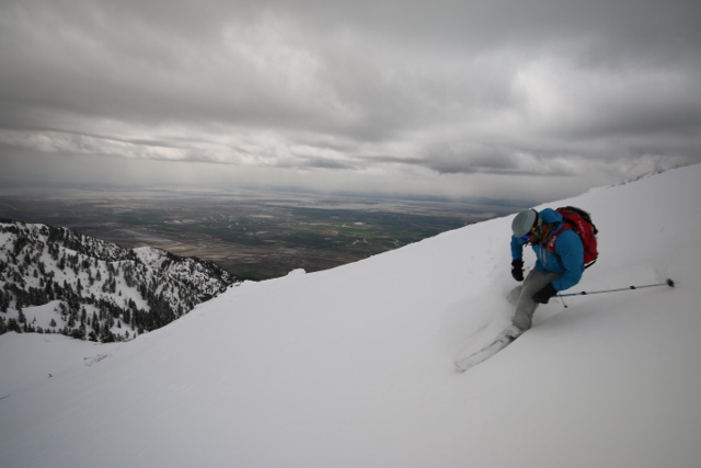
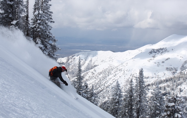
Boy what a run! Considering the late season, I expected very little in terms of snow and line quality, but the Wellsvilles did not disappoint. For thousands of vertical feet, we skied on a mix of schmoo on the verge of becoming mashed potatoes, down to primo corm where wet slides scraped off the buttered surface. The ridgelets were long and had consistent fall-lines, and as when one would end in cliffs, a short traverse to the next ridgelet to the south gave us another snowfield to play on for a run that went forever.
At the bottom, a little bit of bushwhacking got us back to the main trail and the car, and not a moment too soon as the approaching storm started to send sheets of rain down on us. As we drove up Sardine Canyon back to Salt Lake, we checked out the Wellsvilles above with a new appreciation, as these “little” steep mountains are actually big on terrain and fun skiing.
I’m looking into doing the route from Rattlesnake Canyon to Box Elder Peak. Looking at Caltopo, it’s a bit of a daunting route with travel under or connected to lots of steep faces. What route did you guys decide on, and would you have changed anything?
Do you have a Caltopo route plan or anything you should show?
Hey Jonathan, yes there are a few open bowls that must be traversed and/or climbed to reach Box Elder from Rattlesnake. There are also terrain traps. It’s tough to avoid this. You’ll just have to make the trip when you are confident that snow layers are stable enough to not slide. With no avalanche forecast you have to be your own forecaster. Keep on eye on the weather and snowfall in the region weeks in advance. Use the Logan mountains forecast to get a general idea of what’s up.
I wrote a detailed ascent route with a map in my guide book. Here is the link: https://www.mountaineers.org/books/books/backcountry-ski-snowboard-routes-utah
I really wouldn’t change anything about the route in hindsight. It basically follows the summer trail route.
Let me know if you have any questions and… good luck!