The Waterpocket Fold is one of the most unique geological features in Utah. A nearly 100-mile long wrinkle in the earth’s crust, the Waterpocket Fold offers stunning views of the classic Wingate and Navajo sandstone formations. And because it’s in a remote section of a lightly-visited park, it offers great hiking without crowds, especially if you go in winter.

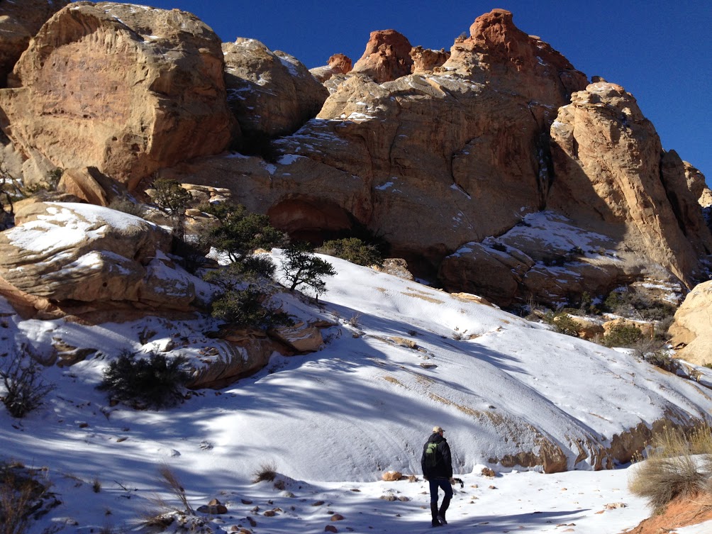
There are a few different options for exploring the Waterpocket Fold, but perhaps the most direct is the 9-mile loop through Upper Muley Twist Canyon and along the rim of the Fold itself. I did the hike in late December with my dad after an epic powder day in the Wasatch left an inch or so of fresh snow throughout Capitol Reef. The contrast of white snow, red rock, and blue sky was incredible.

The hike starts out fairly mellow as you work your way up the bed of the canyon. In spring through fall, this is obvious flash flood country so be cognizant of the weather before heading into the wash. For us, the main concerns were 20 degree temperatures as well as slick, icy conditions. Fortunately, there aren’t many super-exposed areas, so the snow didn’t cause too many problems.
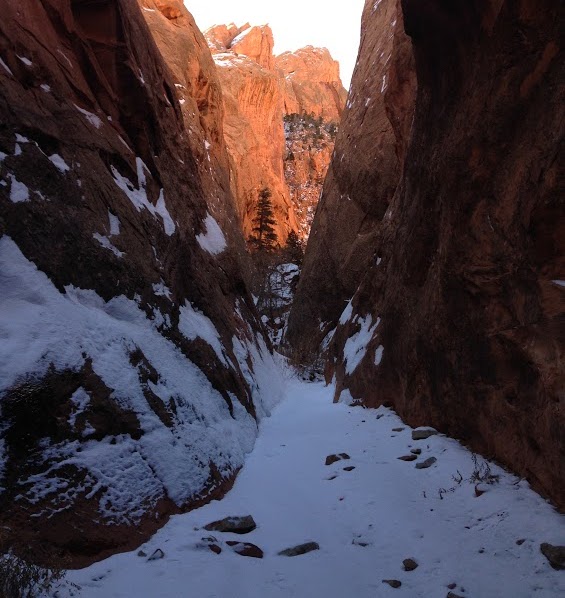
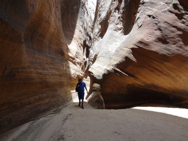
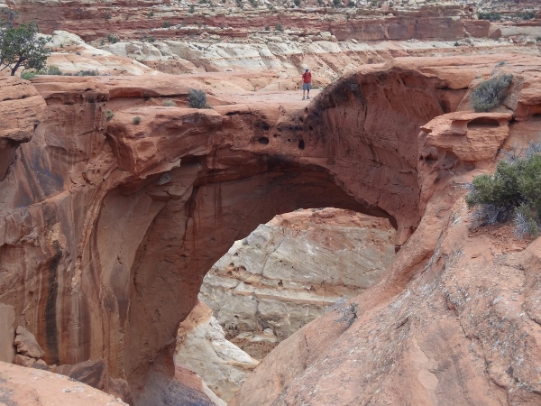
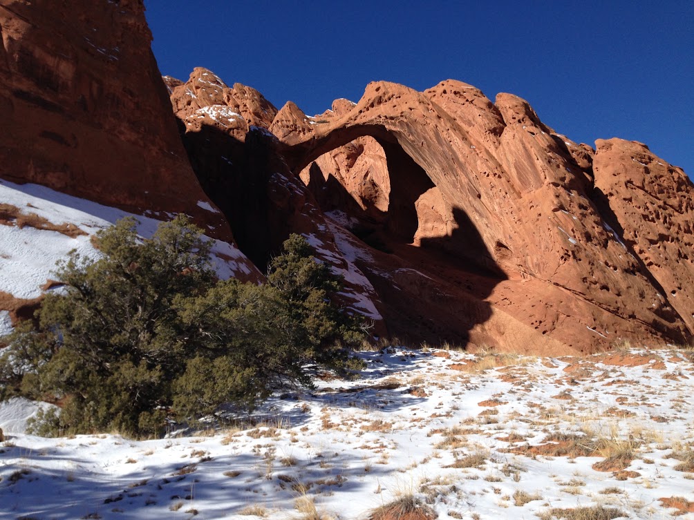
There generally isn’t much of a trail as you follow the canyon north. Be on the lookout for several arches along the way, some high above the canyon. The largest arch, Saddle Arch, is about 1.7 miles in.
The actual loop begins at Saddle Arch. From here you’ll continue hiking through the canyon, keeping right whenever there’s a fork in the road. At about 4 miles in, the canyon finally narrows up. At this point, a set of rock cairns points you out of the canyon toward the rim, as the narrows eventually become impassible. This is where things got a bit interesting on our winter hike as the trail above the narrows is sometimes steep and slick, but again, it was never really so exposed to make it a problem. The trail above the narrows eventually comes back to the bottom of the canyon for a short while before climbing (and scrambling) again to the top of the Waterpocket Fold.
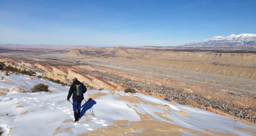
The view at the top is awesome in both directions. The Henry Mountains tower to the east and Upper Muley Twist drops down to your west. Follow the cairns south along the ridge for a few miles as you work your way along the fold. We eventually lost track of the cairns (we blame it on the snow) and walked in circles for a bit before finding the trail to descend back into the canyon just across from Saddle Arch.
In total, the trip took us about 6 hours, including breaks, route finding, exploring, and getting momentarily disoriented (that’s the nice way of saying “lost”). In summer or Fall, I think 4-5 hours would be a better bet. There’s a decent description with mileage and driving directions available on the NPS website here. We started at the upper trailhead at the Strike Valley Overlook parking area, which required four-wheel drive and high ground clearance. There is a lower parking area that is accessible in any vehicle, but it adds on another 5-6 miles of hiking along the road.