Broads Fork, located in Big Cottonwood Canyon in the Central Wasatch, is an excellent hike complete with a shady trail that climbs through stands of evergreens, waterfalls and creek crossings that ends at a spectacular view of high-alpine peaks in the upper basin. While the hike shares the same parking area as neighboring Lake Blanche Trail, Broads Fork sees only a fraction of hiker traffic, making it a great alternative for those who seek a more solitary, outdoor experience.
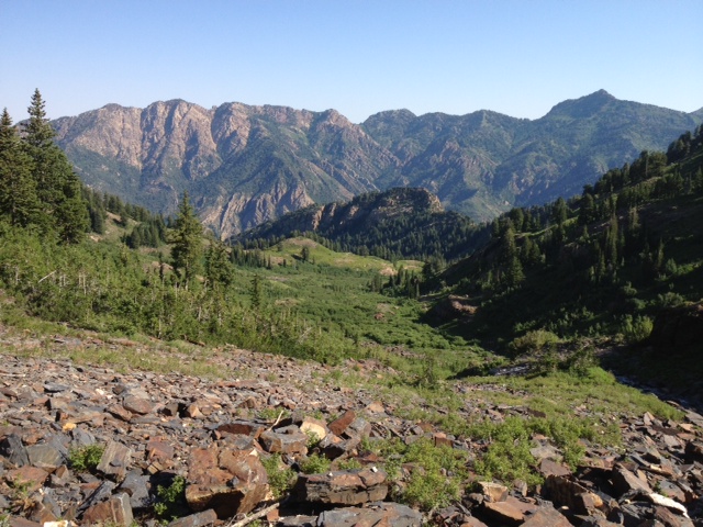
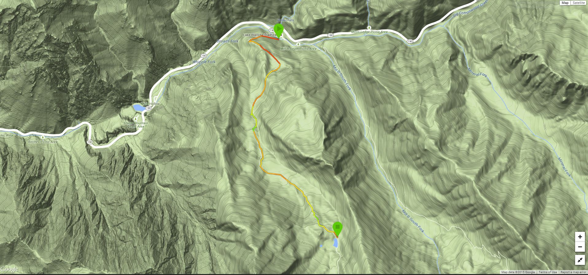
The trailhead is located in the small parking lot at the S-Curves, 4 miles up Big Cottonwood Canyon Road. It is tucked away in the southwestern corner of the lot. Immediately, the trail gets steep as it traverses the mountainside west above Big Cottonwood Creek and the highway below. In 0.25 mile, the trail makes a sharp switchback and heads south up into the drainage proper. Views are almost non-existent here as you hike through a dark, old-growth forest. In spring or late fall, this often poses a problem of ice on the trail, but during the hot summer months, the evergreens provide a respite from the brutal sun, making Broads Fork an ideal hike May-September.
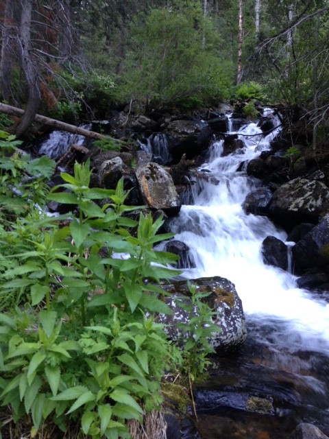
From the switchback, the path parallels a flowing creek that cascades over several waterfalls. There are many places you can go off-trail to take a photo, and there is a single bridge-crossing that goes over one of the most beautiful waterfalls in the canyon. Along the way, you can also check out a rock-climbing crag where quickdraws hang from a cliff where climbers are attempting to complete difficult projects.

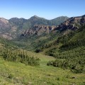
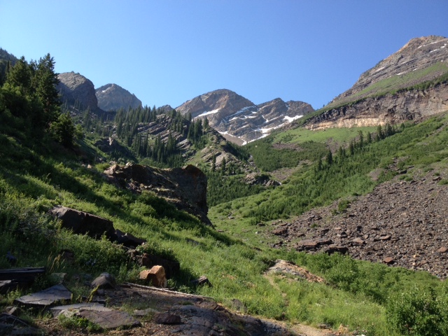
In 1.4 miles, the evergreens thin, the foliage opens up, and you get your first glimpse of upper Broads Fork. The trails also levels out here as it crosses a small meadow before getting steep again, this time in an aspen grove. Beyond the aspens, the trail levels once again until you come to a fork. For a short day hike with the best views, go right for a few hundred yards where the path ends at the “Lunch Flat.” Here you’ll find a collection of boulders where you can sit, grab a bite to eat, and enjoy the landscape before you. It’s a classic, alpine view filled with wildflowers, small lakes and streams, and a panorama of snow-streaked mountains like Dromedary, O’Sullivan (Sunrise), and Twin Peaks. Don’t forget to look behind you to the north for another view of Big Cottonwood Canyon’s dramatic walls far below.
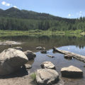
For a bit of a longer hike, you can walk to a small, alpine lake that’s nestled just below Lunch Flat. Back at the fork, go left and follow the trail as it goes down to the bottom of a meadow. The lake levels are often low but can be picturesque during spring runoff. Look for a family of ducks swimming in the waters while you’re there. It’s 2.25 miles from the trailhead to the lake.
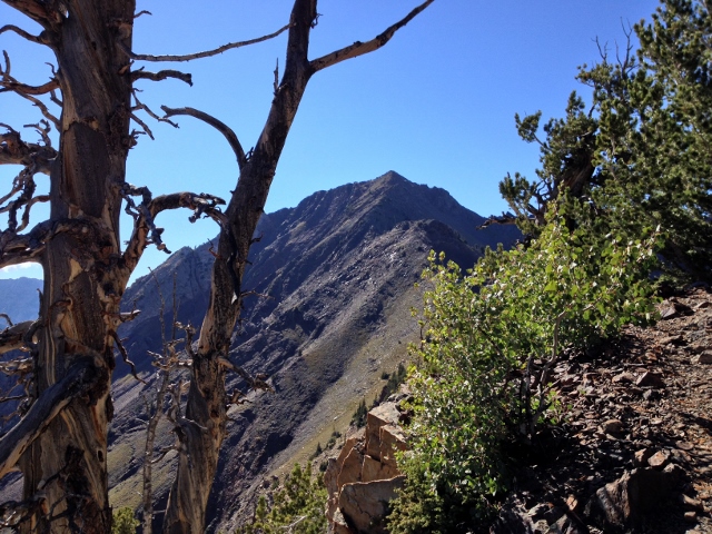
Both Lunch Flat and the lake are good end-points for a day hike in Broads Fork. Of course this route description is the start of an ascent of Twin Peaks, which you can bag if you’re so inclined. To do it, keep going up the trail until it ends in the upper meadow. Generally follow the stream into the upper bowls and scramble directly up the mountain to a saddle between O’Sullivan (Sunrise) and Twin Peaks. From here, scramble up the ridge on loose scree to the top of Twin Peaks.
Overall, if you’re looking for a shady, steep hike with a nice payoff in a mountain view that’s close to Salt Lake City, you can’t go wrong with Broads Fork.
Getting There: From Salt Lake City, take the I-215 East Belt to the 6200 South Exit. Go east on Wasatch Boulevard to Big Cottonwood Canyon Road, Go left (east) and drive 4 miles up the canyon to the S-Curves. There is a small parking lot that is often full. Additional parking can be found alongside the road. Locate the Broads Fork trail in the southwest corner of the lot.