Purple areas on maps are often a non-starter for me. The purple indicates “high use” zones; places where you are sure to find loads of other hikers and campers. Personally, I go backpacking in part to escape from crowds, get lost in the surroundings, and enjoy some peace and quiet. It was with some trepidation that a buddy and I headed for one of the most well known purple circles on the High Uintas map: Grandaddy Basin. Could an area that gets so many visitors truly feel wild? Would the splendor be any less splendifourous with so many fellow campers? There is only one way to know for sure, so we buckled our waistbelts and started hiking.
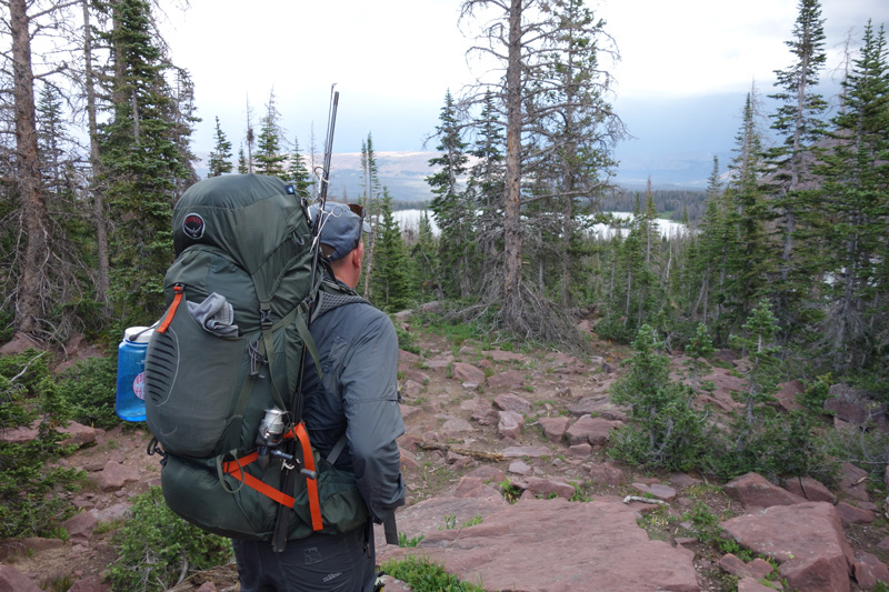
The trek begins at the Grandview Trailhead, at the end of Hades Canyon Road. There are plenty of parking spaces and vault toilets. When we arrived on a Friday morning, there were already at least 40 cars in the parking area. Unfazed, we shouldered our packs and hit the trail. The first 2.5 miles of hiking are uphill to Hades Pass. Elevation gain is just under 1,000’; steep but not lung-busting brutal. The trail is well maintained and mixes between packed or loose dirt and solid rock in places. The views into Grandaddy Basin from the top of Hades Pass are excellent; Heart and Grandaddy Lakes are easily visible, and just a short hike away. In fact, the western shores of Grandaddy Lake are just 4 miles from the trailhead. No wonder this basin and its namesake lake are so frequently visited!
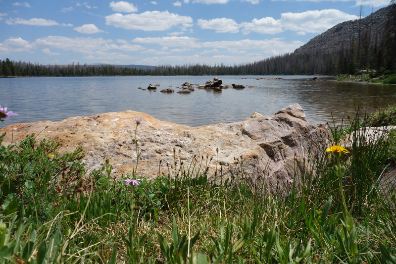
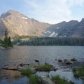
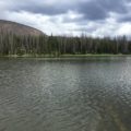
Since Grandaddy Lake is the largest in the basin, and the closest to the trailhead, we decided to avoid it entirely. Our destination was only a couple miles further: Mohawk Lake. We chose Mohawk due to the fact that the only established trail ends on the eastern shore. Sure enough, a hike to the west side of the lake near the inlet gave us complete solitude! We found an ideal camping spot nestled in some pines a few hundred feet from the lake’s shore. Remember, in these high use areas, you must camp at least 200’ from any water source, and cannot have a campfire within ¼ mile of any lake. We enjoyed the rest of the afternoon, and explored some tiny lakes and ponds near camp. Finding some solitude is possible, and the next day we set out to see just how beautiful the rest of the basin is.
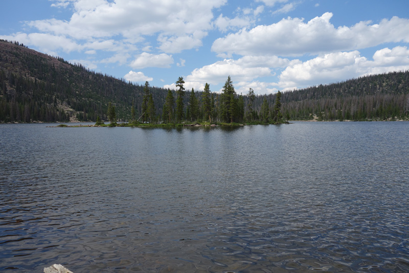
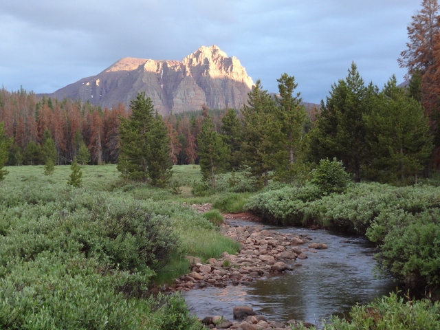
We started our second day with a summit of West Grandaddy Mountain. From our base camp at Mohawk Lake, it was a great non-technical hike to the peak at 11,494’. After lunch, we scrambled from our camp area cross country until we linked up with the trail to Fish Hatchery Lake. The rest of the day was spent exploring the area up to and around Pine Island Lake before slowly making our way back to camp. After a full day in the Grandaddy Basin, I was won over: this is an absolutely beautiful area and worthy of more visits.
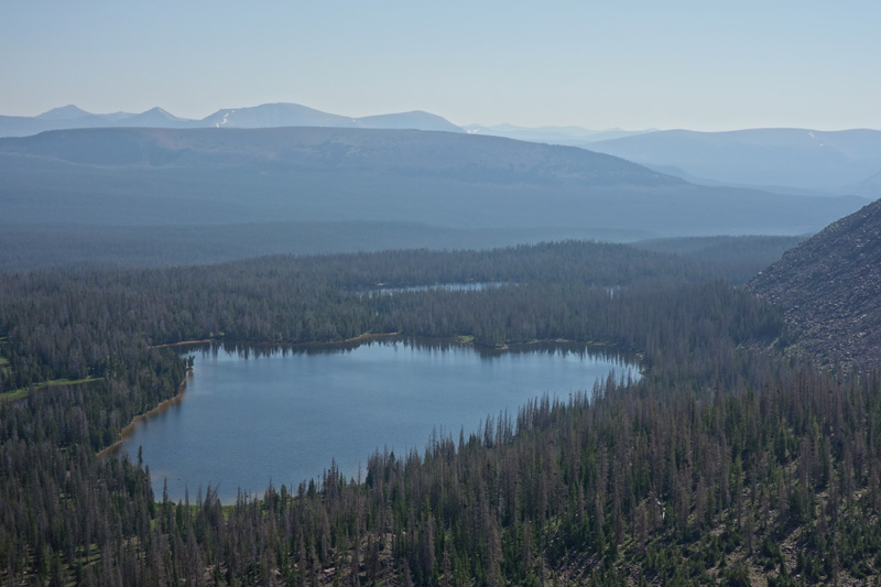
The trails in the basin are well maintained, and provide easy travel between the 15+ lakes in the area. And speaking of those lakes…wow! I was impressed by the size and features of almost every lake we visited. Each one had its own personality, and I’d be hard pressed to name you an area anywhere else in the Uintas where you could visit so many bodies of water in a single day.

After a long weekend in Grandaddy Basin, I might have gotten past my fear of the purple color on maps. There is no reason to be deterred from visiting these spots, as they are usually very popular for a reason. If you tread just a bit off the beaten path, solitude is not only possible, but rather easy to come by. And surely, there is no shortage of amazing sights in this classic Uinta basin.
Getting There: From Salt Lake City, take I-80 towards Park City. Follow the signs for US-40 East, then turn left onto UT-248 East to Kamas. From Kamas, head south on UT-32 toward the town of Francis, then turn left onto UT-35 East. Drive up and over Wolf Creek Pass and enjoy the amazing scenery on the way. Before reaching the town of Hanna, turn left onto UT-144. Follow this paved/graded road past Defa’s Dude Ranch, and look for the signs that point to the Grandview Trailhead. The final six miles are a dirt road that switchbacks up the side of the mountain, but should be passable for any vehicles in the summer months.