
If you think Strawberry Reservoir is just for boating and fishing, think again. There’s actually a pretty amazing bit of singletrack that many consider to be one of the prime trails in the entire Heber City/Strawberry area. It’s called the Strawberry Narrows Trail, and this hiking/horseback/mountain biking path offers buff dirt, killer views, and a…
Tag: guide
Hiking to Alexander Basin
Alexander Basin, located in Mill Creek Canyon, is a beautiful hike to glacier-carved bowls on the north side of Gobbler’s Knob, but has a notorious reputation of being very steep. But steep doesn’t mean long, so if you’re in the mood for a leg workout, but don’t have a lot of time to hike, then…

Utah Mountain Biking Guide: Wasatch Crest to Dog Lake to Mill D
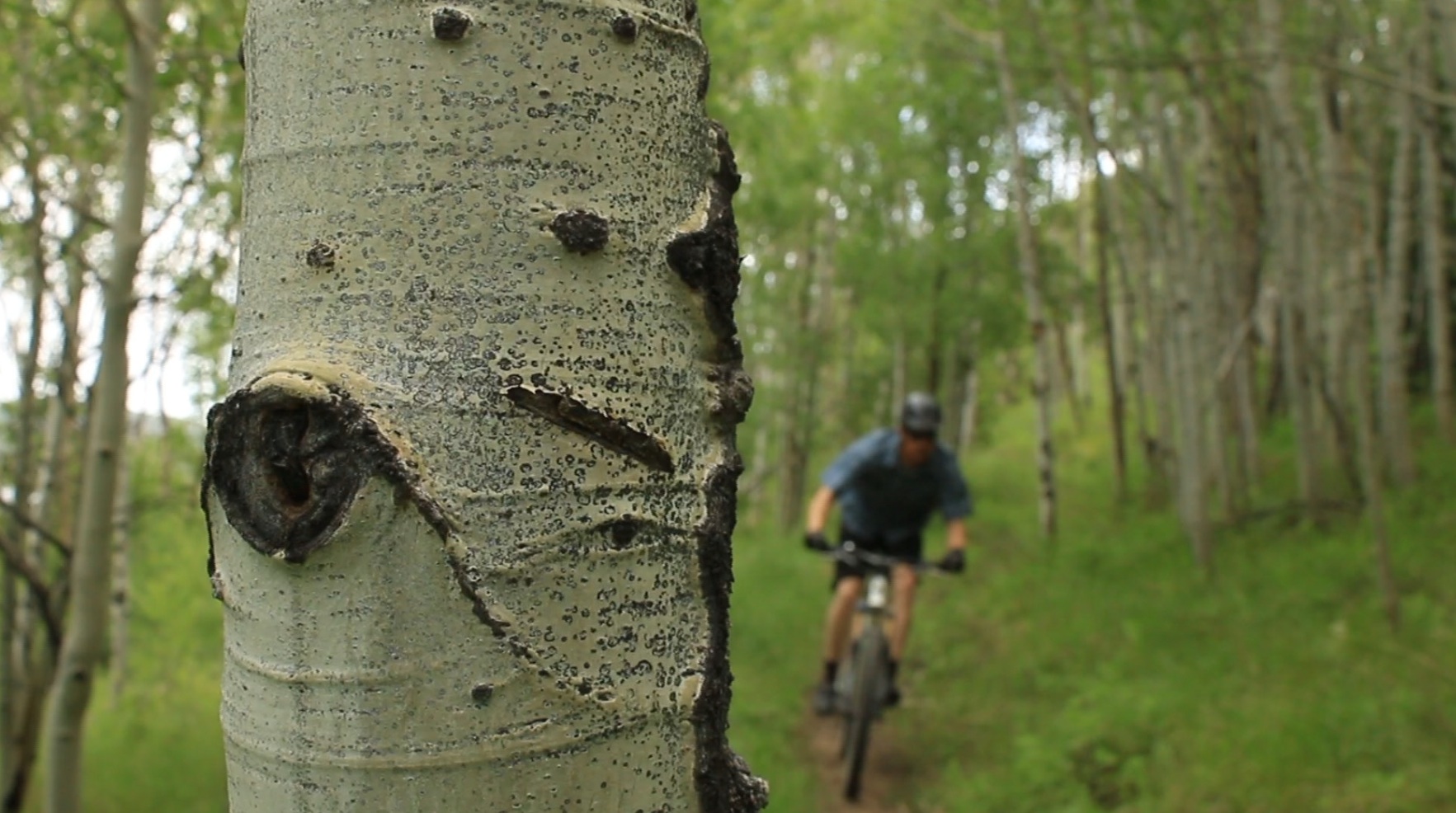
Start Point: Guardsman Pass, 9720 feet Elevation Gain: 1,437 feet Elevation Loss: 3,645 feet Trail Distance: 15.4 miles (one way) Trail Time: 3 hours, 30 minutes Skill Level: Intermediate/Advanced Best Season: Summer The Wasatch Crest Trail is probably the most famous mountain biking route in the Salt Lake area. There are many good reasons for its legendary status, such as…
Utah Mountain Biking Guide: Jass-Chrome Molly Trail
Start Point: Jass-Chrome Molly trailhead, 5875 feet High Point: Loop high point, 6175 feet Trail Distance: 6.6 miles (round trip) Trail Time: 1 hour, 20 minutes Skill Level: Intermediate Best Season: Spring/Fall The Jass-Chrome Molly Trail (also spelled “Jazz-Chrome Molly,” I couldn’t discern which is correct either way) is a Vernal area original. This 6.6-mile loop is…
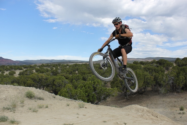
Utah Mountain Biking Guide: The Flume Trail
Start Point: The Flume trailhead, 9950 feet High Point: Apex of upper loop, 8300 feet Trail Distance: 18 miles (round trip) Trail Time: 4 hours Skill Level: Intermediate Best Season: Spring/Fall The Flume Trail has been described as one of the most classic mountain bike rides in the Vernal area. This excellent singletrack winds up through a scenic canyon along mountain…
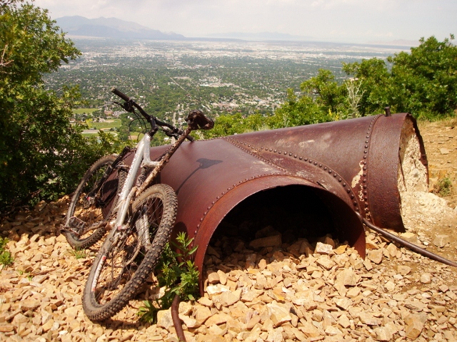
Utah Mountain Biking Guide: Pipeline Trail
Start Point: Mill Creek Canyon winter gate, 6100 feet End Point: Pipeline Trail viewpoint, 5960feet Trail Distance: 13.6 miles (round trip) Trail Time: 2 hours Skill Level: Beginner Best Season: Spring/Fall The Pipeline Trail is one of Salt Lake’s premiere, beginner, mountain-bike trails. It’s relatively flat, has few technical rocky sections, and there are several…
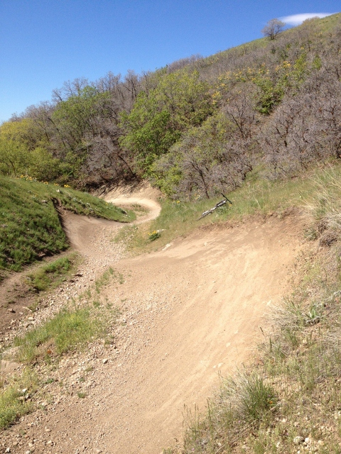
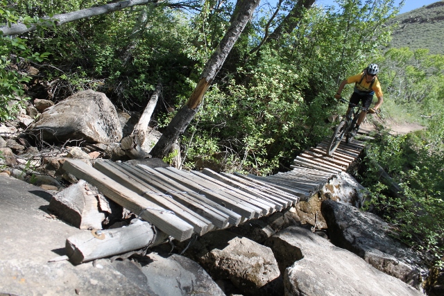
Utah Mountain Biking Guide: The Bobsled
Start Point: Popperton Park, 4860 feet High Point: Bobsled start, 5800 feet Trail Distance: 5.9 miles (round trip) Trail Time: 1 hour Skill Level: Intermediate/Advanced Best Season: Spring/Fall The Bobsled is easily Salt Lake City’s most popular, notorious and swooping-fun downhill ride. It’s a wild descent from the Bonneville Shoreline Trail filled with a semi-technical series…
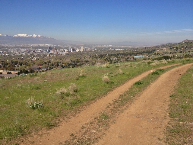
Utah Mountain Biking Guide: Emigration to Dry Creek Canyon
Start Point: Bonneville Shoreline Trail – Emigration trailhead, 4900 feet End Point: Dry Creek Canyon, 5050 feet Trail Distance: 7.8 miles (round trip) Trail Time: 1 hour Skill Level: Beginner/Intermediate Best Season: Spring/Fall The Bonneville Shoreline Trail is among the most popular mountain biking routes in the Salt Lake Valley. Quick access from the city, lofty views, and enough…
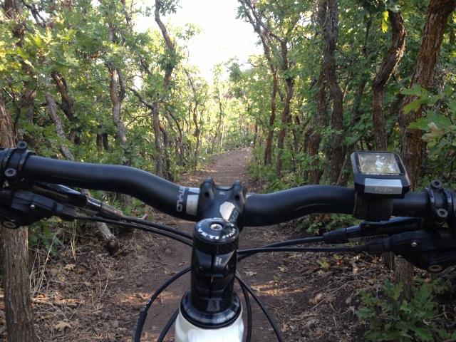
Utah Mountain Biking Guide: Wild Rose Loop
Start Point: Wild Rose Park – 5,200 feet High Point: 5,550 feet Trail Distance: 2 miles Trail Time: 30 minutes Skill Level: Beginner/Intermediate Best Season: Spring/Fall The Wild Rose trail system in North Salt Lake is a short loop that’s good for a quick morning singletrack jaunt, but lacks size for a destination area. A relatively easy section of…