Utah may be known for its world-famous powder, but spring is the best time to backcountry ski big lines in remote ranges. A more stable snowpack and warm, sunny weather are both advantages. But also consider that snow-bound roads melt out, allowing access to far-flung peaks. This time of year, you may be tempted to hang up your skis and get out the bike (or golf clubs). That would be a mistake, because March through May (and even into June) is prime time for bagging big summits and making tracks on marquee routes.
Obviously the Central Wasatch is home to many spring-skiing classics. But the other ranges in Utah can be even better. Take a road trip and explore Utah’s desert mountains. Or say closer to home and head west to make tracks on the other peaks you can see from your house.
Below is a list of my favorite spring backcountry skiing routes in Utah, in no particular order. These routes and many more are found in my book: Backcountry Ski and Snowboard Routes: Utah.
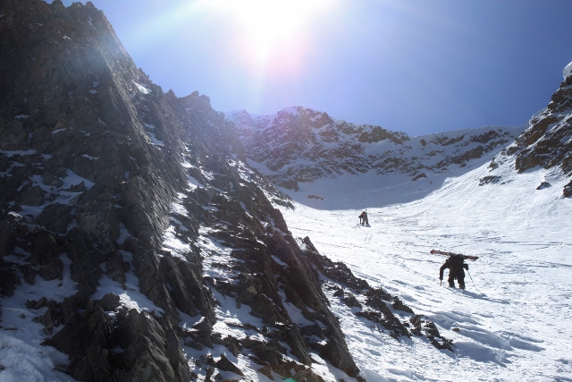
Deseret Peak’s North Twin Couloirs
The Stansbury Mountains in Utah’s West Desert may seem an unlikely place to go skiing and snowboarding, but classic ski and mountaineering routes exist on Deseret Peak, the highest point in the range. Three chutes including the North Twin Couloirs and the East Couloir allow 1,300-feet of fun skiing between summit cliffs on snow that lasts well into summer. Access can be difficult as the road in South Willow Canyon closes in the winter, requiring snowmobiles or a 13-mile round trip skin. Most parties wait for the road to open halfway to Scout Camp where bikes can be used to dispatch road miles, or you can wait for the full road opening to the Loop Campground, usually around Memorial Day Weekend.
To ski the couloirs, skin up Dry Lake Fork to the base of the twin chutes and boot pack up one of them. I recommend the east (lookers left) couloir as your ascent route. At the top, you might as well continue up and summit Deseret Peak.
After taking in the view from the top, descend your Twin Couloir of choice. At the bottom, hang out in a safe zone until afternoon to witness the spectacular show of wet avalanches cascading down the summit cliffs.
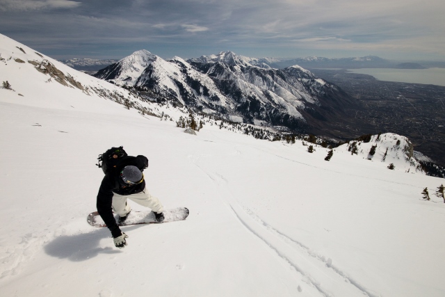
Lowe Peak in the Oquirrh Mountains
Corn skiing mecca. That is what Lowe Peak and neighboring Rocky Peak become when spring hits the Oquirrh Mountains and warm, sunny days are followed by below-freezing nights. When that consistent corn cycle engages, grab your skis or splitboard and head to Ophir Canyon, pronto! A hike-in-your-ski-boots approach over dozens of creek crossings keep things interesting, but the trouble is worth it as both mountains sport massive, southeast, south and southwest-facing headwalls and bowls that catch the morning sun, which softens the snow into al-dente corn so you can carve crescent curves for thousands of vertical feet. If conditions are prime, you can easily link both peaks together for an epic, late-season day.
To get there, skin up Ophir Canyon from the end of the road until you reach the base of Lowe and Rocky Peak. Climb and ski Rocky Peak first as it gets the morning sunlight. In the afternoon, head over to Lowe Peak and choose one of three distinct runs that fall from the summit, separated by sub ridges. All are open bowls on a south aspect that offers over 2,000 vertical feet of skiing, and each will have you salivating when the corn snow glistens under a blue bird sky.
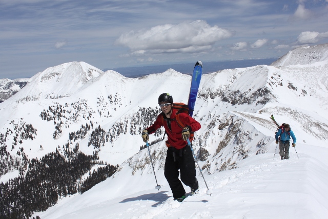
Mount Nebo
Mount Nebo is the highest peak in the Wasatch Range. It’s also the southern-most point, so it sees much less traffic than her urban sisters up north in Salt Lake. Winter and spring finds Nebo especially devoid of people as access is difficult and the approach is long. Mount Nebo is named after the biblical overlook in Jordan where Moses was granted a view of the promised-land he would never enter. If you have the moxie to make the climb, you’ll find a skier’s promised land of challenging couloirs, forested gullies, and fantastic views from the highest perch on the Wasatch Front. But be prepared for a strenuous, all-day adventure on expert-only descents through steep couloirs. My line of choice is the Northwest Couloir.
To ski it, drive up Mona Pole Road as far as your truck can make it, then skin the rest of the way. Leave the road where it intersects a large slide path and take this up to the base of the Northwest and Champange Couloirs. Boot up either of the chutes (I prefer Northwest as it’s wider and less steep) and top out on Nebo’s Summit Ridge. The Champagne Couloir puts you just north of the true summit, while the Northwest Couloir spits you out to the south, where a short, 300-foot hike on loose talus gets you to the top. Either option provides a thrilling ski or snowboard descent that totals almost 3,000 vertical feet to the bottom of Pole Canyon Basin.
Mount Tukuhnikivatz
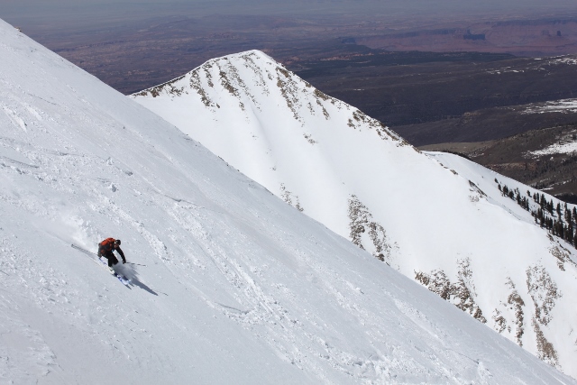
No skier has ever visited Moab for mountain biking or rock climbing, and hasn’t looked to the horizon at the snow-covered La Sal Mountains without thinking that they’d like to ski there someday. And of all the peaks visible from Moab’s red rock paradise, Mount Tukuhnikivatz is the pyramid that stands out the most, with a vertical relief that will make any skier or snowboarder salivate. Locals just say “Mount Tuk” for short, but the full, hard-to-pronounce name is a Native American word that roughly means “where the sun sets last.” As for the tour, climbing and sliding down Mount Tuk is a springtime tradition when stable corn snow allows safe travel on this prize of a desert peak.
To ski this classic, skin up Gold Basin to the base of Mount Tuk’s northeast face. Head south directly toward the mountain and switchback up the broad bowl to the base of some vertical rock ribs. Straps skis or boards to packs and hike the remainder to Tukuhnikivatz’s east ridge at around 12,000 feet. To bag the summit, traverse the ridge west for a quarter mile and enjoy dizzying views of the red desert far below as you boot pack up the summit pyramid until there is nothing left to climb.
To descend, you can pretty much ski or snowboard off the summit in any direction, but the easiest way to return to your vehicle on a sweet run is to make turns down the ascent route on Tuk’s northeast face back into upper Gold Basin then retrace your skin track to the car.
Another classic spring descent is Tuk’s southeast face, an epic run that locals call “Tuklear Reaction.” This 2,500 foot legendary slope holds perfect, smooth corn after basking in the sun all morning. You can ride down as far as you want, then skin back up to the saddle on Tuk’s east ridge where you can descend Mount Tuk Cirque and Gold Basin.
Mount Mellenthin
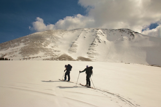
Mount Mellenthin is the second highest peak in the La Sal Mountains, and is also among the most popular to ski because of relatively easy access. Still, getting to the summit along the north ridge then skiing down chutes and bowls on her classic north face is no cake walk. The ascent ridge is steep and covered in loose talus, and the ski down requires careful navigation of summit cliffs and rock outcroppings. But if you arrive when there is plenty of snow, the winds are light, and the sky is filled with blue and the brilliant desert sun, then Mellenthin will treat you to the La Sal’s fantastic views and al-dente spring corn skiing that’s always worth the effort to get there.
To get there, skin up Geyser Pass Road. Just before reaching the pass, go right into the evergreen forest toward Mellenthin’s massive north face. Once you get to the base, ascend the north ridge all the way to the summit.
The skiing and snowboarding down Mellenthin’s North Face is incredible. A series of steep chutes that converge in an open bowl are guarded by cliffs and rocks just below the summit ridge. If snow coverage is good, you can find an alley through rock outcroppings to pick through with your skis on. Otherwise, carefully down-climb to the snow until the coast is clear for a long, classic La Sal descent.
More Information

For detailed information, driving directions, route descriptions, and topographic maps with the ascent and descent routes, pick up a copy of my book. Backcountry Ski and Snowboard Routes: Utah is available from Mountaineers Books.