
Summer is almost over, and we all want to send it out on a high note. One last big banger to put an exclamation point on the season. Maybe you’ve already done Kings Peak, or maybe you just want something with less crowds. Either way, hiking Mount Agassiz in the High Uintas Wilderness is a great way to end the summer. Consider all the major draws: Agassiz is over 12,000 feet tall, is just 7 miles from the trailhead, and towers over the gorgeous Naturalist Basin area… highlights like those make it an easy choice. The best part? You can do this one in a single, long day or turn it into a memorable overnighter.

The easiest way to summit Mount Agassiz is from Naturalist Basin. The Highline Trailhead is 33 miles northeast of Kamas on Mirror Lake Highway. There is a sign for the Highline Trail just after you pass Butterfly Lake. The parking lot is large, but can fill up quickly late in the season. My hiking partner and I arrived at noon on a Monday, and the trailhead was bustling with at least 200 teenagers on a youth group backpacking trip. This portion of the Highline Trail is extremely popular because of the close proximity to numerous basin and lake areas just miles from the road. No time to linger with the crowds, let’s hit the trail!
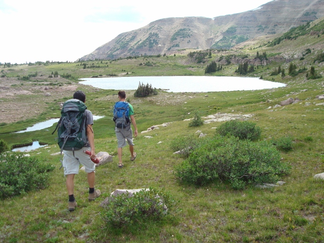
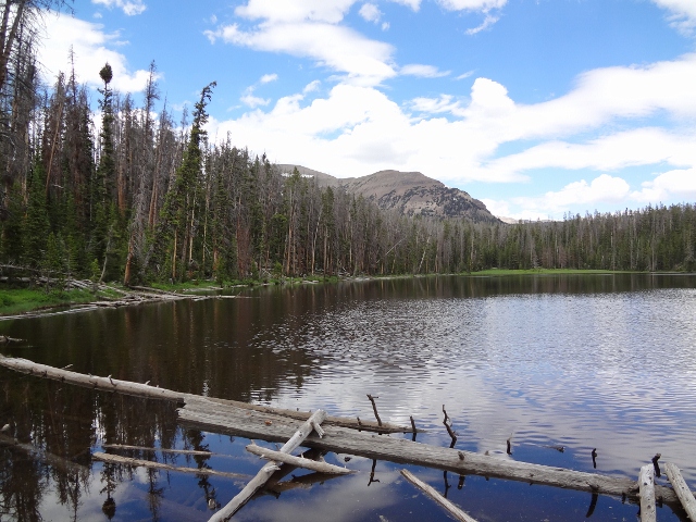
The route to Naturalist Basin isn’t particularly difficult, but it sure is pretty. The trail loses and regains several hundred feet of elevation while winding through the usual sites of the High Uintas. Lodgepole pine forests, towering peaks and mountain meadows await in the miles ahead. This area is never short on natural beauty. Hikers pass the Mirror Lake trail .8 miles into the hike; at mile 2.2 a spur trail to Scuddar Lake veers to the right. Soon after Scuddar Lake, the trail to Packard Lake is passed. It’s only a few miles more miles to paydirt.
The Naturalist Basin Trail is roughly 5 miles from the trailhead. Take a left at the sign and gain some elevation on the rocky route. Soon you will begin to see the streams and small ponds that make this area so desirable. Keep your eyes peeled for the sign to Blue Lake. Take a left where the trail forks and continue up the small but well worn path. In just a few minutes, hikers will arrive at a small pond surrounded by a marshy area. The trail stops at the pond; contour around it and head into the trees on the northwest side. You will be able to pick the trail up again once in the shelter of the trees. From here it is easy to follow, just head up the steep path before arriving at the Morat Lakes area. There are several good campsites near the shore of both lakes, but be warned, these are usually popular destinations for many hikers, youth groups included. For more privacy, and an even shorter climb to Mount Agassiz, continue up the rugged trail until you reach Blue Lake at 10,900′.

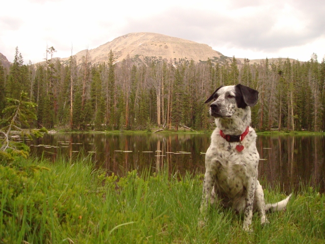
Nestled in the shadow of Agassiz, Blue Lake is truly gorgeous. Its deep, clear water is bordered by small cliffs and rocky shores. There are some great campsites on the east side of the lake in a small meadow. Cliff walls, boulder fields, pine groves and the lake itself provide the perfect setting for a relaxing night. It gets dark earlier than usual in the shadow of mighty Agassiz; our sunset was around 6:30 in late August! Make sure to pack extra layers because the cold sets in as soon as the sun disappears, and there are no campfires allowed in Naturalist Basin. Get a good night of rest to prepare for you summit bid.
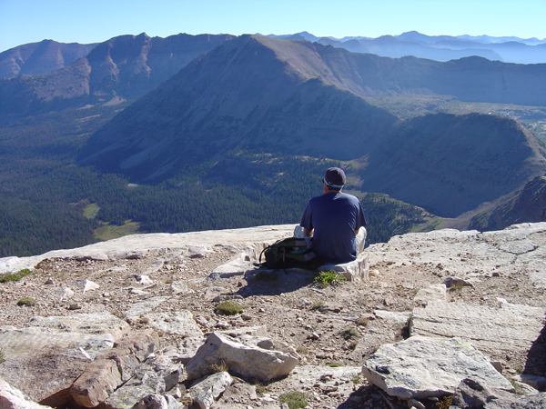
Wake up early and load up on a good breakfast; it’s not far to the top but it’s not easy, either. There is no trail to the top of Agassiz, but the route is obvious. From the east side of the lake, hike due north towards the obvious shoulder on the ridge. It is steep going here, but grassy areas provide some relief. Once you reach the ridge, the views begin to open up. Due north and just below your feet is Middle Basin, another stream and lake filled destination for backpackers. Don’t get distracted just yet, there is plenty of time for that up top. Follow the ridge west towards the summit. Pick your way through the car sized boulders and sheer cliff faces; most obstacles can be easily overcome by contouring to your left. The summit ridge may seem intimidating, but I would rate it as a lower Class 3 or heavy Class 2. A strong leader should have little or no problems helping novices the peak.

The top of Agassiz is a wide open boulder field. Two large cairns can be found on top; the cairn on the north edge marks the true summit at 12,428′. Sign the register and read some of the posts; so few hikers summit Agassiz that we found entries from as far back as 1988! A true testament to the solitude you can find here.
The view from the peak is nothing short of spectacular. Hayden Peak towers to the northwest; Spread Eagle peak looms to the northeast. All of Naturalist Basin can be viewed below you, and looking south will reveal the backside of the Wasatch, including the readily visible Mount Timpanogos. Enjoy your time at the top and return the way you came. Your feet will be a bit heavy on the hike back to the car, but the sights make it well worth the blisters.

The distance from the Highline Trailhead to Blue Lake is just over 6 miles. From Blue Lake to the summit it is 1 mile and 1,500′ elevation gain. You can do this hike in one long day as an out and back of 14 miles, but why go iron man?
Naturalist Basin is truly a gorgeous area, and well worth staying the night. If you leave early enough on Day 1, you could summit Agassiz before nightfall, or take some time to explore the upper reaches of Naturalist. Or create your own variation; whatever you choose, trust that the Mount Agassiz/Naturalist Basin hike is a great option to send your season out on a high note.
Doing this THIS weekend!!!! Turning it into a one night backpacking trip with some friends and dogs.
Awesome! Have a great time, but bring some rain gear. Looks like a 60% chance of showers Saturday. I’ll be summiting Kings Peak this weekend… it’s gonna be cold and wet!
I love King’s Peak! We did it as a two day backpacking trip last August. I always expect it to rain every afternoon in the Uintas. Glad I have good rain gear 🙂