
Gobblers Knob. It may be a funny name for a mountain that evokes a mere turkey hill, but is actually a prominent peak on the Big Cottonwood – Millcreek Canyon ridgeline. The Knob is a frequent destination peak to bag for summer hikers, due to its relatively easy ascent, and multitude of trails that wind to the top from various drainages. From Millcreek, you can summit from Porter Fork, Bowman Fork or Alexander Basin. On the Big Cottonwood side, Butler Fork is the best option.

For the purposes of this article, I’ll describe the Butler Fork approach. The trailhead is located eight miles up Big Cottonwood Canyon, and begins at a dirt pullout on the north side of the road. The trail is marked by a large sign. Follow the path as it meaders along a stream and crosses a wood bridge. From here, the hike immediately gets steep as it rises above the creek on the side of the drainage. At the top, you cross another bridge which leads you to the Mount Olympus Wilderness Area.

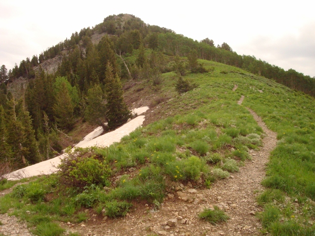
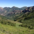
This is when the hike starts to get really pretty. Huge aspen trees extend into the Utah sky, surrounded by a blanket of wildflowers and bushes. Soon after the second footbridge, there is a fork. Go left toward Mill A Basin. The path switchbacks several times until it tops out on a ridge of Circle All Peak which can be summitted by taking the left fork here. To get to Gobblers Knob, go right and enjoy the view of Mill A Basin and Mount Raymond in the distance.

The trail switchbacks a few more times before traversing the south flank of Gobblers Knob through more aspen forests. Keep your eyes peeled for moose as they tend to hang around in the bushes here. A short distance later the trail ascends to Baker Pass, the shoulder between Mount Raymond and Gobblers Knob. A good way to summit two peaks in a single day is to go left and bang out Raymond, then come back and tackle Gobblers. But if The Knob is the only mountain on the agenda, then a right turn will put you on the correct path.

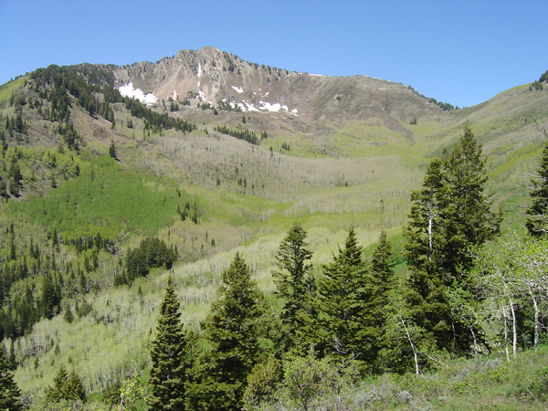
The climb here becomes steep and rocky as you hammer your thighs up the grade. This part of the hike can be aggravating, as several false summits trick you into thinking the end is near, only to discover there is more to go. Eventually, the real summit of Gobblers Knob comes into view and a short traverse on a ridge gets you there. At the top, find a rock seat, crack open a beverage and some well-deserved snacks, and take in one of the most amazing 360-degree views in the tri-canyon area.

Multiple access points, a relatively short hiking distance, and spectacular views of the Wasatch Range make Gobblers Knob an easy choice when looking for a quick weekend hike or a summit to stand on. The distance from the trailhead to the 10,246-foot summit is around 4 miles for an 8 mile out-and-back trip.

What’s the distance to the top of Goblers from Butler trailhead?
About 4 miles.