
The San Rafael Swell, located in Central Utah, is an often overlooked recreation gem. The Swell is a geologic maze of rock formations, canyons, plateaus and sagebrush flats. Through it all lies a network of dirt roads, 4×4 tracks, and singletrack trails that cater to every recreational discipline.
In addition to outdoor fun, the San Rafael Swell is home to a deep history. Remnants of the past are scattered among the sandstone walls and cracks. When exploring the Swell, you may encounter ancient pictographs, petroglyphs, outlaw signatures, and even dinosaur tracks.
I’ve spent many years exploring the San Rafael Swell, and notched many memorable adventures. From mountain biking to hiking, off-roading to camping, and even canoeing, there’s something for everyone down at the Swell. I’ve compiled a breakdown of several trips you can take inside the Swell. This list only scratches the surface of activities the area offers, but it is a good introduction to this mysterious and magical place.
The Wedge Overlook
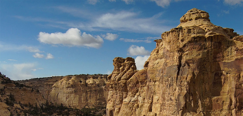
Never been to the San Rafael Swell? Then the Wedge Overlook should be at the top of your list. This much-visited vista overlooks a chasm of canyons and washes, carved by wind and the San Rafael River far below. Often called “The Little Grand Canyon,” the view is similar to the famous national park in northern Arizona, but on a smaller scale.
The Wedge Overlook is located at the end of a well-maintained gravel road that any passenger vehicle can negotiate. This 20-mile road begins north of the overlook on SR-10 near the town of Castle Dale. Several signs show the way. Once you arrive and step to the edge, the world falls away thousands of feet down. Stay for an hour to enjoy the view, or stay the night at an adjacent campground.
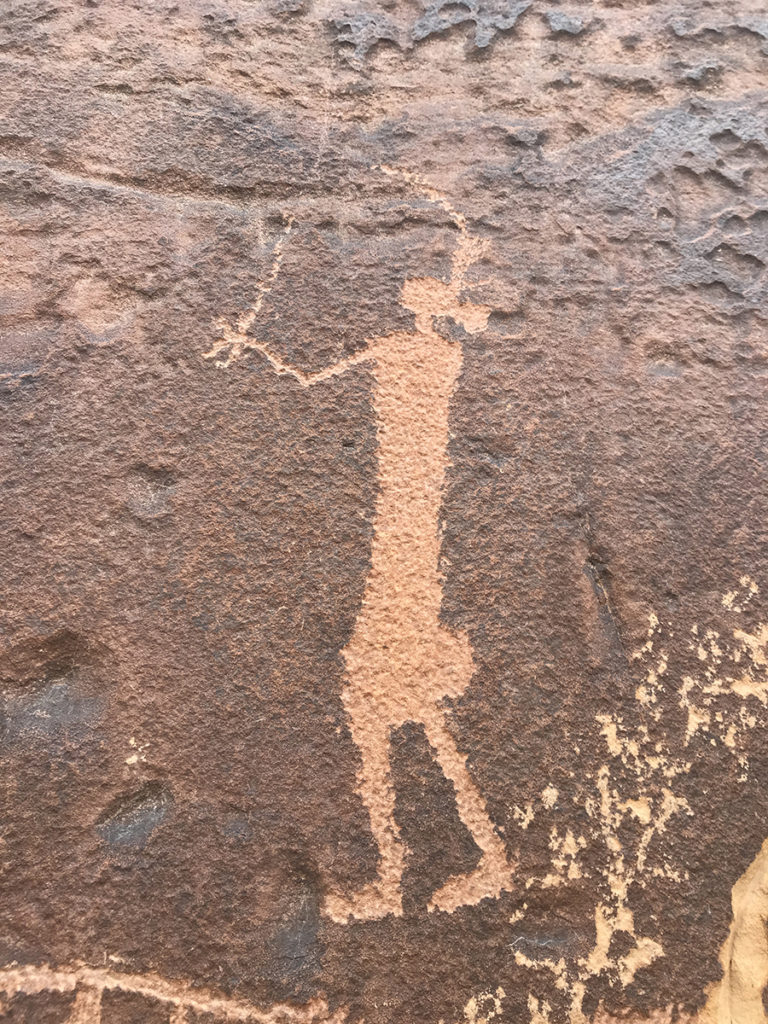
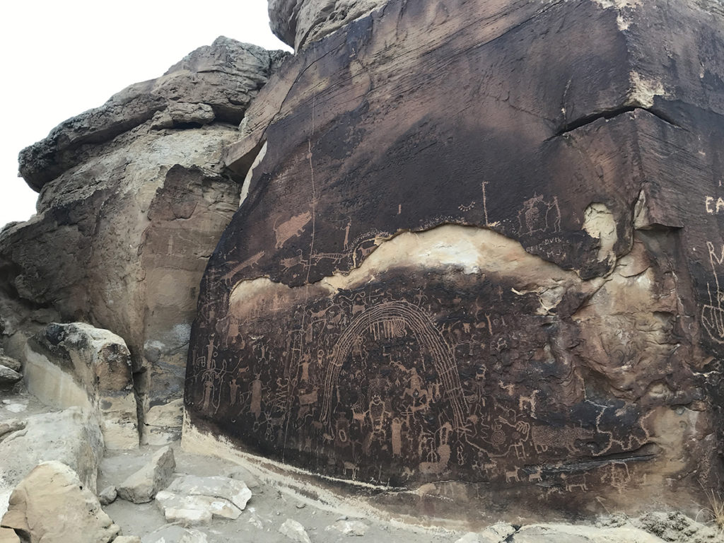
Buckhorn Wash Pictographs
If you drive to the Wedge Overlook, a side-trip to Buckhorn Wash is an absolute must. There are many roadside attractions like dinosaur prints, and the signature of Wild Bunch gang outlaw, Matt Warner. But the most jaw-dropping sight is the Buckhorn Wash Pictograph Panel. Painted hundreds, if not thousands of years ago by prehistoric peoples, these anthropomorphic figures are absolutely captivating.
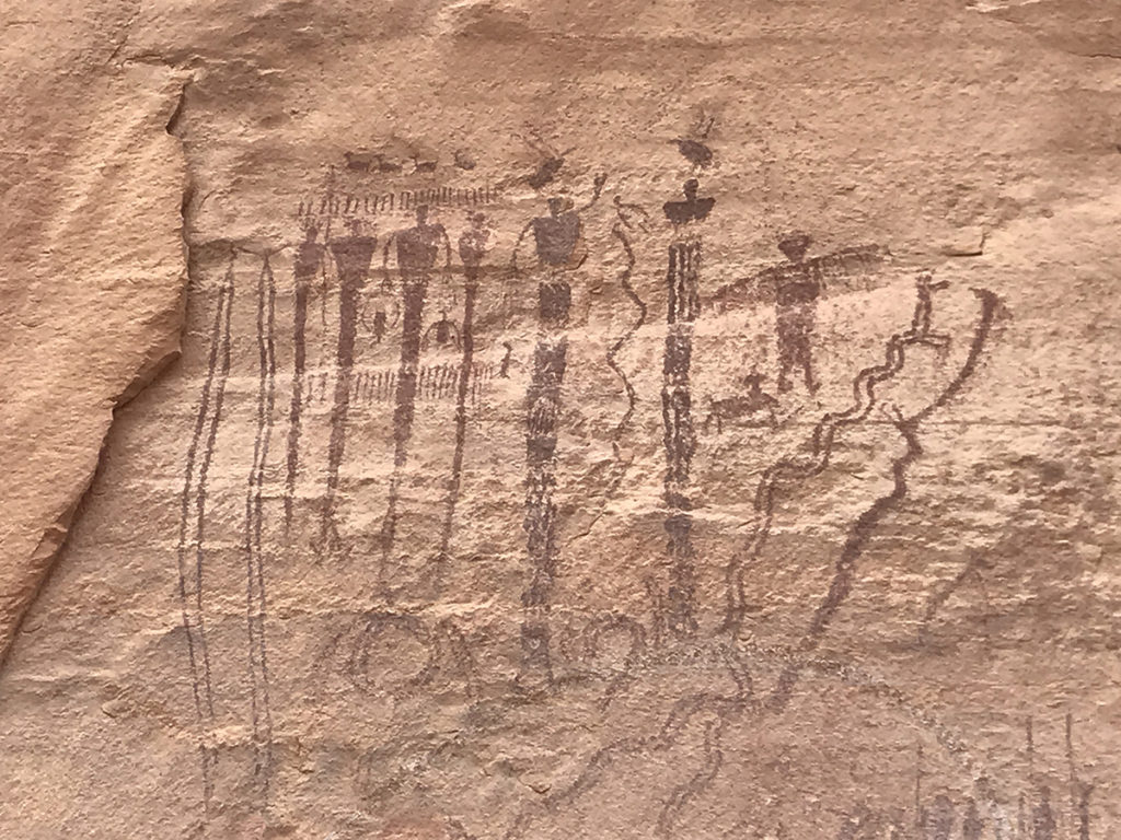
The panel is very easy to find as it’s located on the side of Buckhorn Wash Road. There is a parking area, outhouse, and a shady picnic area. A paved path allows easy access to the panel, and numerous interpretive signs detail the history of the panel.
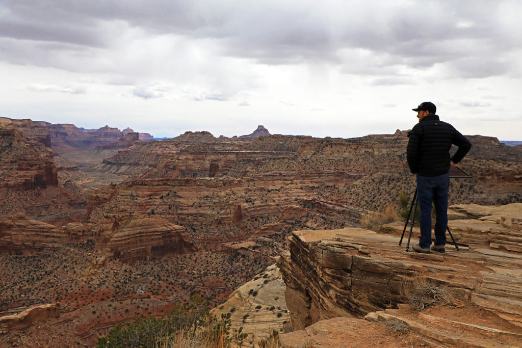
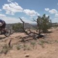
Mountain Biking the Good Water Rim Trail
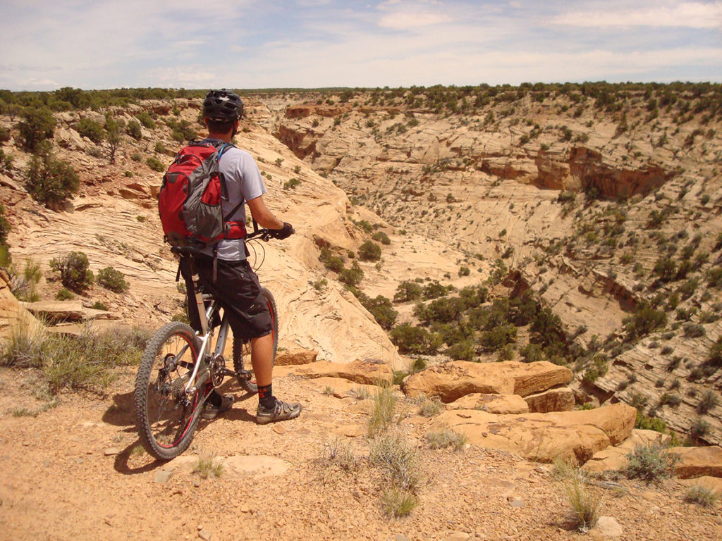
One of my favorite activities in the San Rafael Swell is mountain biking the Good Water Rim Trail. This excellent singletrack follows the rim of Good Water Canyon, an offshoot of the Little Grand Canyon near the Wedge Overlook. Pedaling on the edge, riders get views of the gorge that cannot be seen from a truck.
Good Water Rim Trail features 15 miles of desert singletrack. The entire ride requires constant pedaling over rocky slabs, occasional dips and countless, tight turns that never let up. It’s a conundrum in that the trail is easy enough for beginners, but will slap riders down for inattentiveness or fatigue. Good Water Rim is a true “cross country” ride.
The trail is typically done as a loop that starts and ends at the parking lot of the Little Grand Canyon Overlook. After riding the 16 miles of singletrack, a quick, 6-mile return on dirt roads brings you back to your car. To get to the Good Water Rim Trail, drive to Price and exit onto highway 10, going southbound for 28 miles to Castle Dale. Just before town, there’s a dirt road that goes east with a sign that says “San Rafael Access.” Drive down this road and follow the signs that directs you to the Wedge Overlook. At the overlook, turn left and follow the road a 1/2 mile to the Little Grand Canyon Overlook. You can begin the ride here, or find a campsite and start from there.
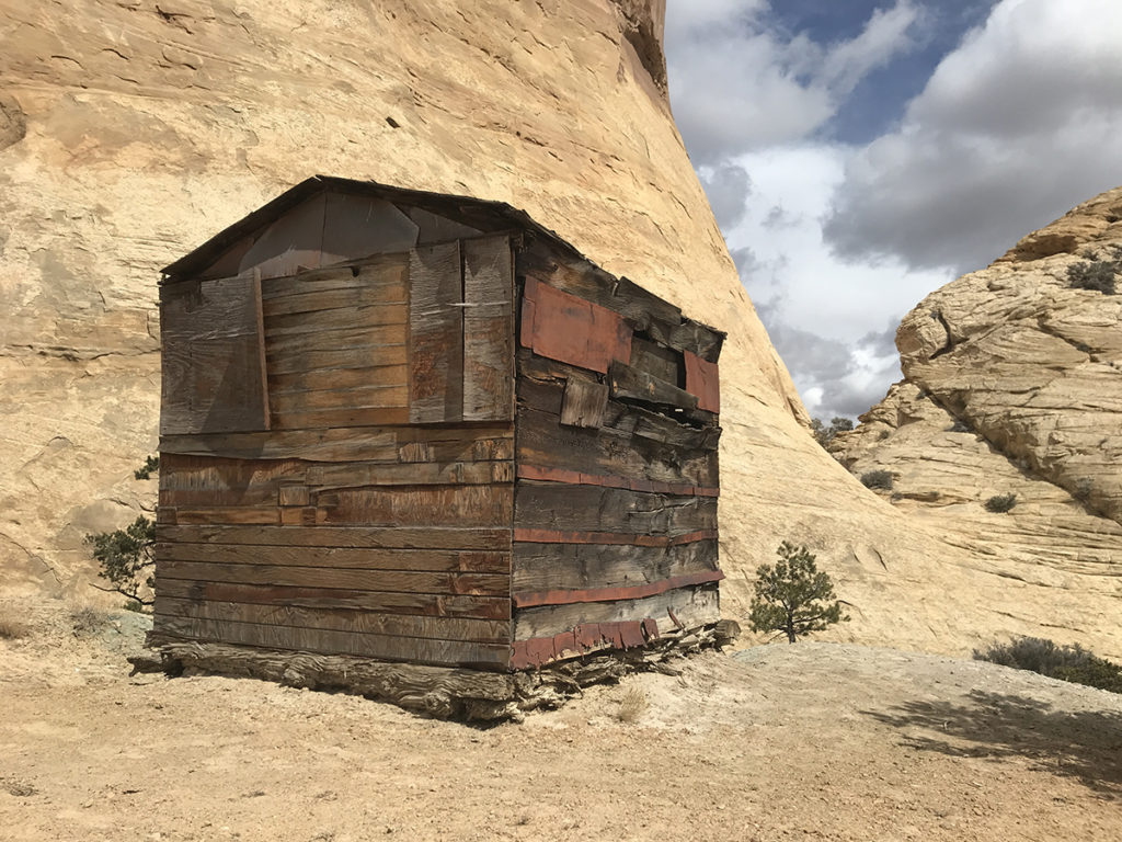
Swasey’s Cabin and Eagle Canyon Arch

Just off I-70 on the south side of the San Rafael Swell is Swasey’s Cabin. This bit of old-west history is well preserved and easy to get to. The story goes that the Swasey brothers, Joe, Sid, Charley, and Rod, were among the early cattlemen that lived in the San Rafael Swell during the late 1800s and early 1900s.
In 1921, Joe Swasey built this cabin in the middle of the Swell at a time when the area was far more remote than it is today. The family used the cabin to raise remount horses for the U.S. Calvary. A lot of the wild mustangs you see roaming the Swell are leftover from those herds. The Swasey’s also raised sheep. The cabin itself is a glimpse into what life was like in those days. While at the cabin, go down the road a bit to visit the Ice Box. These are caves that stay cool, even in the heat of summer. The Swasey’s used to store food here… natural refrigeration!
Eagle Canyon Arch
If you have an OHV, or want to hike, you can drive down nearby Eagle Canyon for 2 1/2 miles to visit one of the most impressive arches in the San Rafael Swell. Eagle Canyon Arch is a tall rock formation that juts out from the side of an enormous cliff. To my eyes it looks like the handle of a beer stein. Most people get here on 4-wheelers, but you can also walk the trail. Just be prepared to encounter a ton of motor vehicles.
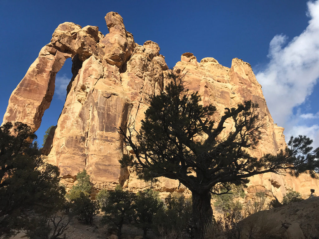
To get to Swasey’s Cabin and Eagle Canyon trailhead, take Ranch Exit 131 on I-70. Go south a piece, then turn west on the dirt road that parallels the interstate. In five miles you’ll come to a sign pointing to Swasey’s Cabin. Follow that road and the signs to the cabin for 7.6 miles.
Copper Globe Mine
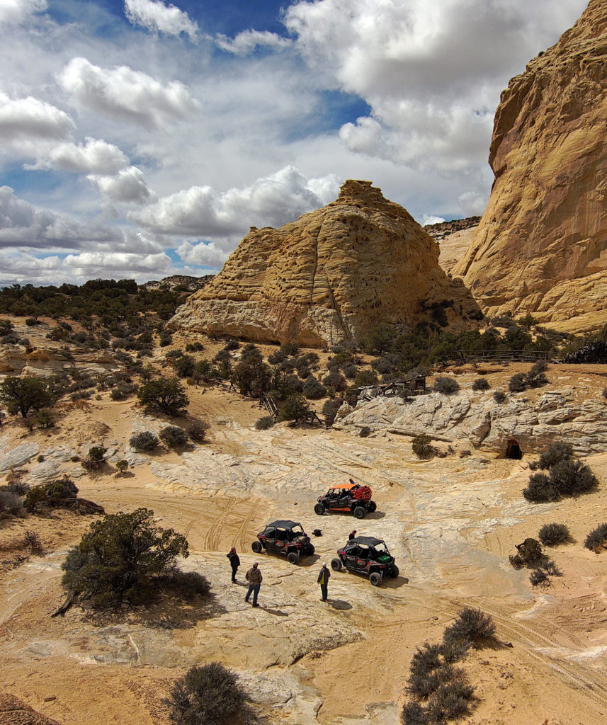
Mining is another historical use of the San Rafael Swell, and ruins of these hundred-year-old buildings and shafts are easily found and explored. One such place is Copper Globe. This old copper mine is named after a rock formation that lords over the area, which looks like a copper globe. The mine was in operation from 1900 through 1905. Evidence of on-site smelting still exists. There’s a 15-foot-high, 75-foot long wood pile, and a smelter just a few feet away from the many horizontal and vertical mine shafts that litter the area. You’ll also find a stone water cistern, and preserved cabins that still have beds, furniture, and fireplaces.
Copper Globe is another attraction best accessed from a UTV or dirt bike, though you could get there on a mountain bike. The dirt road is very rough, steep and rocky. Start your ride at the Justensen Flat trailhead on exit 114 off Interstate 70. Follow trail CR-927 above Devil’s Canyon. It’s about 12 miles round-trip.
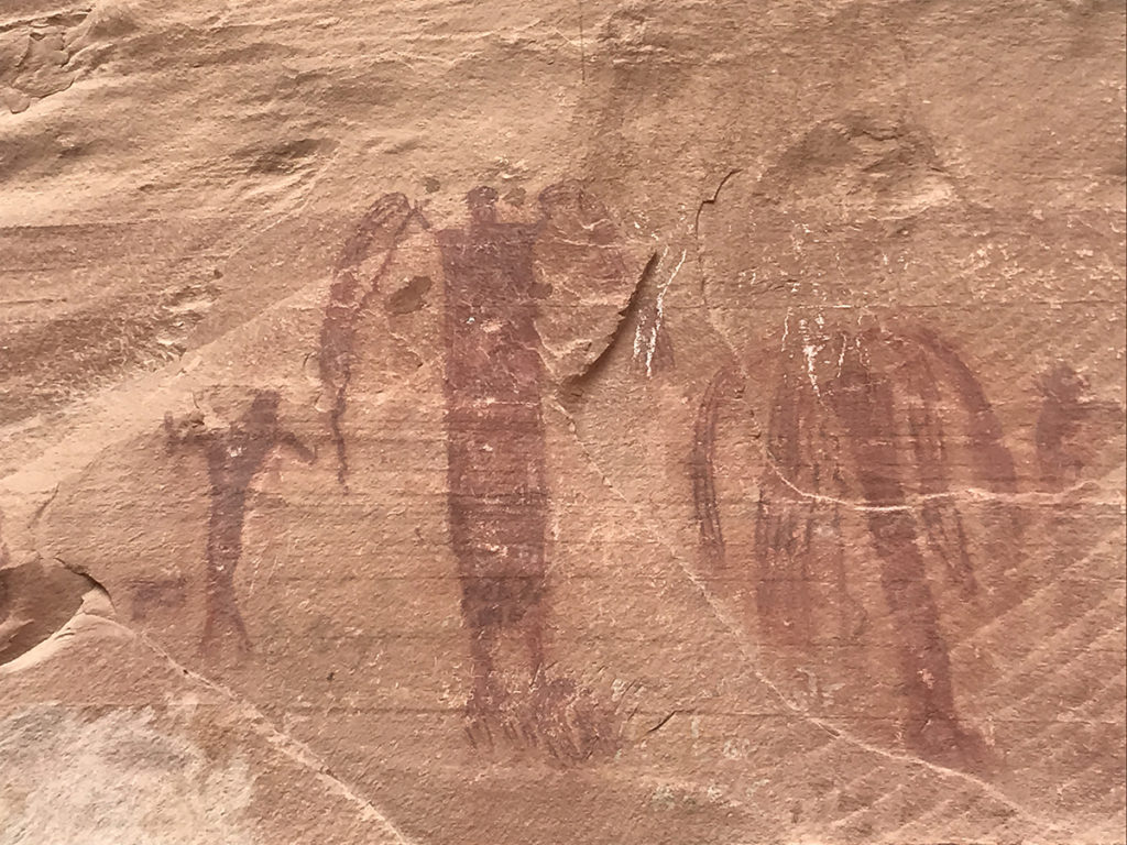
Rochester Art Panel
The Rochester Art Panel is one of the most impressive petroglyph sites I’ve ever encountered. I’d say it even rivals Newspaper Rock in Moab! The panel is a Fremont-culture collage of carvings depicting Barrier Canyon-style people, animals and weird geometric shapes and lines. There’s even a large rainbow. The rock is covered in a dark varnish, which allows the carvings to really stand out.
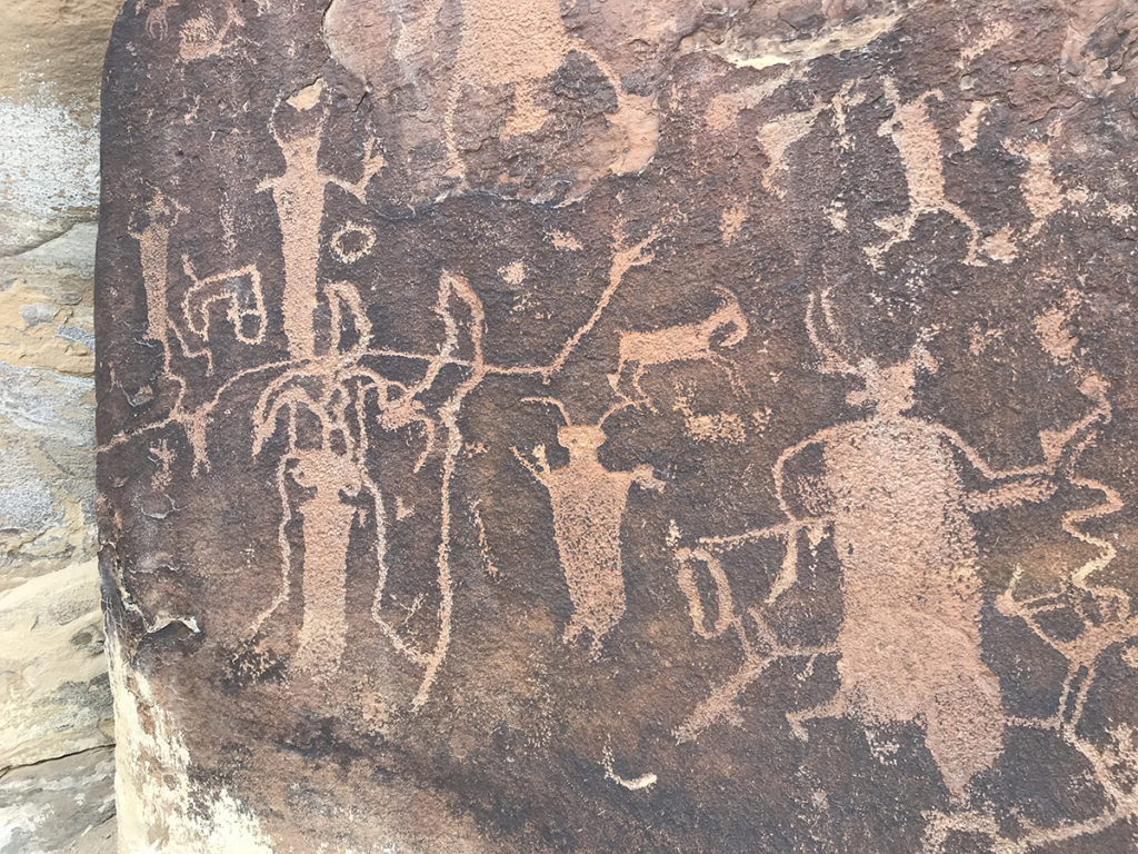
Getting to Rochester Art Panel is easy. Drive south from the town of Ferron on Highway 10, then take the turnoff between mile markers 16 and 17. Head east toward the town of Moore for 0.5 mile. Turn south on a dirt road and drive 4 miles top a parking lot and signed hiking trail that shows the way to Rochester Panel. It’s about a half-mile hike to the site.
Floating the San Rafael River
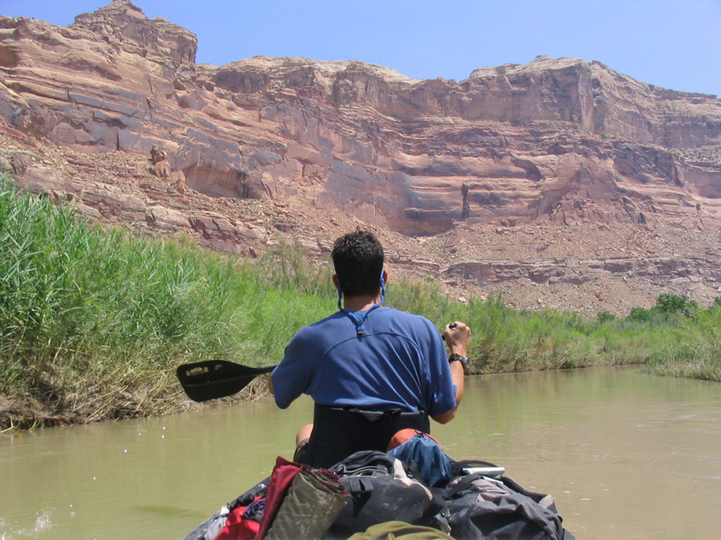
The San Rafael River runs through the heart of the Swell. Most times this waterway is a mere ankle-deep trickle. So how is it possible to float on a boat? It’s all about the CFS. After a good snow year, keep on eye on the river’s CFS, and pull the trigger on a float trip as soon as the river is deep enough to float (around 300 CFS). My preferred way is to put in at Fuller Bottom, and take out at the Swinging Bridge in Buckhorn Wash.
You’ll never forget a trip through the Little Grand Canyon on a boat. I recommend taking a few days by staying a night. Try Virgin Spring Canyon where sandy beaches make for a comfortable place to pitch a tent. Hike up the canyon to find pictographs and a natural spring where you can fill up water bottles.
As the river winds through the Little Grand Canyon, you’ll encounter only a few small rapids. But beware of low water levels and the possibility of getting beached on sand bars. When you come to the swinging bridge, take out and load into the shuttle vehicle you left behind. This 18-mile float trip is is a unique way to explore the San Rafael Swell, and probably the most fun.
Where to Stay
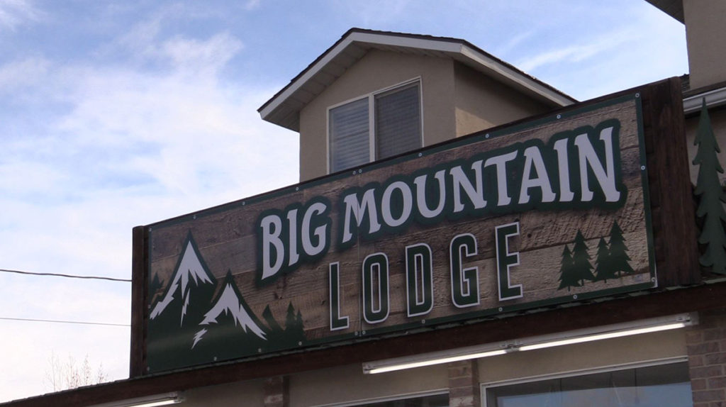
There are tons of places where you can camp out in the San Rafael Swell. While there are a few established campgrounds, all are primitive. You’re better off finding a boondocking site, of which there are many. If camping isn’t your thing, check out Big Mountain Lodge in Ferron. This base camp is newly remodeled and has everything you need like a convenience store, gas station, restaurant, plus rooms and cabins that are clean and quiet. They even rent out UTVs so you can explore the more remote reaches of the Swell. Find them at bigmountainlodgeutah.com.
KSL Outdoors San Rafael Adventure
In early April, I shot and edited a feature about the San Rafael Swell for KSL Outdoors. We went to many of the places described above, and visited other sites that I did not mention. Give the segment a watch and learn how you to can experience all the San Rafael Swell has to offer.


Great Story. The Swell is an amazing place.